Works on: Windows 10 | Windows 8.1 | Windows 8 | Windows 7 | Windows 2008 | Windows Vista | Windows 2012 SHA1 Hash: 85559046202715bafb879214379b1164093305de Size: 136.51 MB File Format: exe
Rating: 2.478260869
out of 5
based on 23 user ratings
Downloads: 240 License: Demo / Trial Version
ACDSee Canvas 12 with GIS+ is a demo software by Acd Systems International Inc. and works on Windows 10, Windows 8.1, Windows 8, Windows 7, Windows 2008, Windows Vista, Windows 2012.
You can download ACDSee Canvas 12 with GIS+ which is 136.51 MB in size and belongs to the software category Others. ACDSee Canvas 12 with GIS+ was released on 2010-11-03 and last updated on our database on 2017-02-15 and is currently at version 12.
Thank you for downloading from SoftPaz! Your download should start any moment now. It would be great if you could rate and share:
Rate this software:
Share in your network:
ACDSee Canvas 12 with GIS+ Description
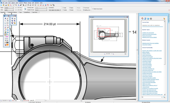
Canvas is the integrated application that speeds up and streamlines your technical illustration workflow. Professionals in high tech, complex environments that require accurate and powerful visualization of technical data rely on Canvas to facilitate collaboration and improve productivity. Experience Canvas 12, the preferred solution for technical illustration in precision industries such as; aerospace and automotive, biotechnology and healthcare, education, government, manufacturing, oil, gas and energy, and technology. Canvas’ GIS+ module, included in this evaluation version, offers a powerful set of GIS-based tools and commands that support all leading GIS formats, define complex map projections, and perform advanced property operations. Canvas provides you with a single integrated software environment for technical illustration. With Canvas, you can work with both vector objects and raster images in the same document. And you have access to a larger range of enhancement tools for any kind of graphic, rather than being limited to certain enhancements on vector objects and others on raster images. As a Canvas user, you have the ultimate in flexibility, with the ability to import existing graphics from over a hundred different standard and specialized formats. Depending on your requirements and preferences, you can draw and edit either freehand or numerically for ultimate precision. Canvas also provides you with the ability to complete your workflow in one application, with its advanced text capabilities, as well as its set of tools for publishing, presenting and collaborating. In specialized workflows that require high level format support and sophisticated methods of data acquisition, visualization and analysis, Canvas has the crucial ability to accurately measure, edit, and export digital images that contain up to 32 bits per channel of data.
Where to buy?
Last updated price and discount information 4 years agoupdate now


 Windows Vista and above
 View Screenshots(2)
 Comments
 Download


 Similar Software
 Recently Searched
 Software Categories
 Trending Software
 Like Us


