Works on: Windows 10 | Windows 8.1 | Windows 8 | Windows 7 | Windows 2012 SHA1 Hash: 2acbd392a063efd7c148cc9a03f7f98aa7c581cd Size: 9.01 MB File Format: exe
Rating: 1.782608695
out of 5
based on 23 user ratings
Publisher Website: External Link Downloads: 485 License: Demo / Trial Version
3D Global Terrain is a demo software by David Aguirre Grazio and works on Windows 10, Windows 8.1, Windows 8, Windows 7, Windows 2012.
You can download 3D Global Terrain which is 9.01 MB in size and belongs to the software category Home and Education. 3D Global Terrain was released on 2011-12-24 and last updated on our database on 2017-03-03 and is currently at version 1.2.
Thank you for downloading from SoftPaz! Your download should start any moment now. It would be great if you could rate and share:
Rate this software:
Share in your network:
3D Global Terrain Description
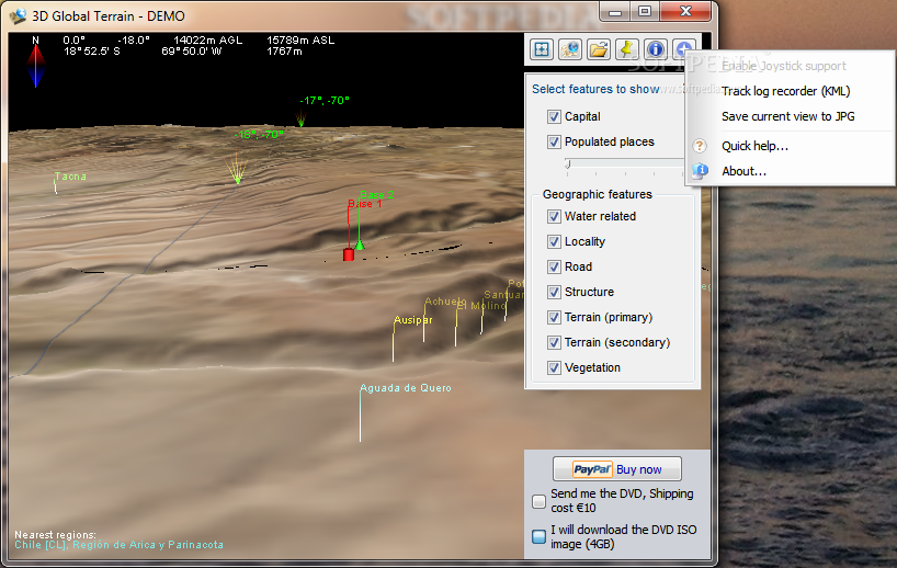
Topography and Satellite imagery: GTerrain has a full copy of the Blue Marble satellite imagery and the Shuttle Radar Topography Mission (SRTM) Data stored in an off-line database (local copy) allowing you to use GTerrain without Internet connection. Both Blue Marble and the SRTM have a fixed resolution of ~450mts per pixel, in order to maintain a relatively low hard-disk space requirement of ~3GB. This important feature will give you the possibility to use 3D Global Terrain in field applications (using it on a Notebook on the road).
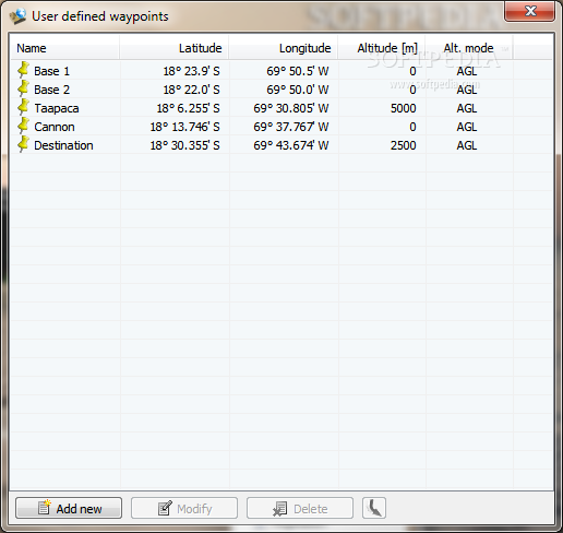
Multi-format file support: GTerrain allows you to load and display Waypoints, Routes and Tracks from many different file formats:
Google Earth KMZ files (kmz)
Google Earth KML files (kml)
GPS exchange format (gpx)
TomTom Navigator overlay (ov2)
TomTom Navigator itinerary (itn)
Magellan MapSend Waypoint/Route files (wpt)
Magellan MapSend Track files (trk)
Garmin Point of Interest (non encrypted only)(gpi)
Palm Address Book files (aba)
NMEA 0183 sentences files (nmea)
SUUNTO Data files (sdf)
Navigon MN6 files (rte)
Navigon MN6 storage files (storage)
Navigon MN5 files (rte)
Navigon MN4 files (rte)
iGO (comma delimited)(asc)
Garmin POI (comma delimited)(csv)
Magellan POI (comma delimited)(csv)
Route66 (comma delimited)(csv)
Navman (comma delimited)(csv)
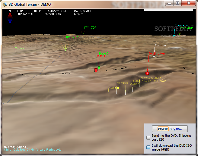
Place names: GTerrain has a full catalog of 2,411,161 countries, capitals, cities, towns, and even historical references and 4,252,852 of additional points of interest like mountains, valleys, lakes, rivers, structures, etc. The names update dynamically, by increasing or decreasing in number according the user proximity and altitude.
3D Engine: GTerrain uses First Person Perspective (FPP), which renders the world from the visual perspective of the user, in a realistic way just as if he were really there. Particular focus was put into the ease of usability, all one needs to control GTerrain is a two button mouse and the arrow keys or just a Joystick.
GTerrain was designed to run on recent PC hardware with 3D acceleration. Please refer to the download section for more information on system requirements.
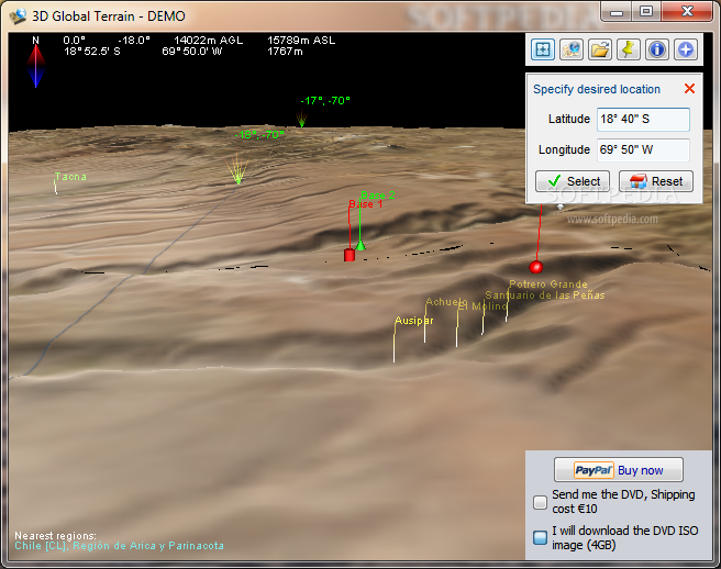
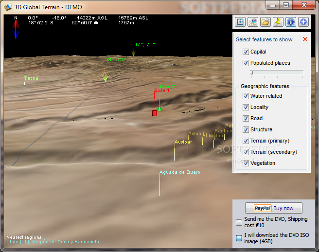
Visual Tools: GTerrain comes with a variety of visual guides that help the user's experience such as latitude and longitude markers, as well as extremely precise coordinate data, like geographic position, compass, heading and tilt indicator, altitude and ground elevation.
Additional features:
Manual position specification.
On-screen indicator displaying nearest country and regions.
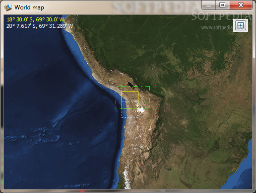
General world map displaying current position.
Track log recorder, create and save real-time tracks to KML format.


 Windows 7 and above
 View Screenshots(6)
 Comments
 Download


 Similar Software
 Recently Searched
 Software Categories
 Trending Software
 Like Us


