Works on: Windows 10 | Windows 8.1 | Windows 8 | Windows 7 | Windows XP | Windows 2000 | Windows 2003 | Windows 2008 | Windows 98 | Windows ME | Windows NT | Windows Vista | Windows 2012 SHA1 Hash: 49fafe2d23919f6c8aad051cadaa282ba5e4a051 Size: 24.59 MB File Format: exe
Rating: 2.3
out of 5
based on 23 user ratings
Publisher Website: External Link Downloads: 215 License: Demo / Trial Version
Cyklotrasy is a demo software by Eagle Software and works on Windows 10, Windows 8.1, Windows 8, Windows 7, Windows XP, Windows 2000, Windows 2003, Windows 2008, Windows 98, Windows ME, Windows NT, Windows Vista, Windows 2012.
You can download Cyklotrasy which is 24.59 MB in size and belongs to the software category Miscellaneous. Cyklotrasy was released on 2011-09-29 and last updated on our database on 2017-04-23 and is currently at version 2.25.
Thank you for downloading from SoftPaz! Your download should start any moment now. It would be great if you could rate and share:
Rate this software:
Share in your network:
Cyklotrasy Description
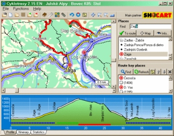
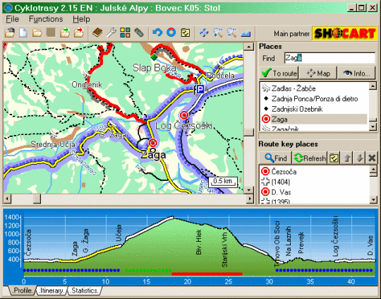
Imagine software, where you can set (from map or list) your starting point, some transit places and the final point of your journey. You can choose searching preferences: type of surface, and let the software plan your own route. The software will get you a lot of useful information: profile of your trail, map, itinerary and statistic data. Cyklotrasy (in english "cycling trails") gives you a lot of information: altitude, latitude, longitude, photos, texts, lengths of distances, nubers of roads, numbers of bike-ways, types of surfaces, hiking and bike marking. You can observe route total length, superelevation, rise and fall. There are also prepared routes, where you can find difficulty and type of recommended bike. You can print profile, map, itinerary and statistic. Visual apperance of profile and map can be adjusted with preferences. You can export profile and map into picture, web site or GPS format. User can make a diary of his/her trips, including a lot of data. Maps are developed by administrators who update maps at least ones a year. At this time, there are 70 maps of Czech republic, 22 maps of Slovakia, 1 map of Slovenia (Julian Alps) and 1 map of Italy (Lago di Garda).



 Windows NT and above
 View Screenshots(1)
 Comments
 Download




 Similar Software


 Recently Searched
 Software Categories
 Trending Software

 Like Us
