Name: Deutschland1789-Interaktiv Works on: Windows 7 and above
Developer:
Version: 1 Last Updated: 06 Mar 2017 Release: 08 Aug 2010 Category: Others > Miscellaneous
Rate this software:
76 downloads
View Screenshots(2)
Comments
Download
Liked it? Tell others:
Deutschland1789-Interaktiv Details
Works on: Windows 10 | Windows 8.1 | Windows 8 | Windows 7 | Windows 2012 SHA1 Hash: a195a082601f036ac5a1c21416ea97e40a7aede9 Size: 1.35 MB File Format: pdf
Rating: 2.5
out of 5
based on 23 user ratings
Publisher Website: External Link Downloads: 76 License: Demo / Trial Version
Deutschland1789-Interaktiv is a demo software by and works on Windows 10, Windows 8.1, Windows 8, Windows 7, Windows 2012.
You can download Deutschland1789-Interaktiv which is 1.35 MB in size and belongs to the software category Miscellaneous. Deutschland1789-Interaktiv was released on 2010-08-08 and last updated on our database on 2017-03-06 and is currently at version 1.
Thank you for downloading from SoftPaz! Your download should start any moment now. It would be great if you could rate and share:
Rate this software:
Share in your network:
Deutschland1789-Interaktiv Description
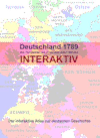
Deutschland 1789 - Interaktiv - German Version35 maps show the structure of Germany (and some neighbouring areas) at the end of the Holy Roman Empire of the Geman Nation and gives direct access to the relevant articles in the online encyclopedia Wikipedia.
Very small territories are not include. Of course the user has to have an online internet connection to use the link function to
Wikipedia. Offline the atlas can be used as well, i.e. naturally
without the connection to Wikipedia.
The purpose is not to document any territorial claims.
Many customs, traditions and even architecture or landscape have their roots in history.
A simple example: why is carneval celebrated in one village but not in the next one only 5 miles away? One was probably part of a catholic territory and the other part of a protestant territory.
Deutschland 1789 - Interaktiv - includes the following maps:
The Holy Roman Empire of the German Nation
interactive map to choose the area to be enlarged
Bavaria
Swabia (Bavarian part)
Baden-Würtemberg Southern Part
Baden-Würtemberg Northern Part
Palatinate
Saarland
Rhineland-Palatinate
Hesse Southern part
Hesse Northern part
Saxony - Thuringia ? Anhalt
Brandenburg
Silesia (1763)
Pomerania
Mecklenburg
Schleswig-Holstein (1730)
Lower-Saxony
South-Western part of Lower Saxony (Bentheim, Lingen and Osnabrück)
Niederstift Münster
Northrhine-Westphalia
interactive map to choose the area to be enlarged
Bishporic of Cologne
Lower Rhineland
Bishopric of Münster ? Southern part
Minden-Ravensberg and Lippe
Bishopric of Paderborn and Principality of Waldeck
Duchy of Westfalen
Ruhr area
Siegerland
Limburg and Liege
Luxembourg
Tyrol (1766)
East-Prussia and West-Prussia
Baltic countries 16. century
Baltic countries end of the 17. century
Baltic countries end of the 18. century
Legend and abbreviations
Where to buy?
Last updated price and discount information 9 years agoupdate now



 Windows 7 and above
 View Screenshots(2)
 Comments
 Download





 Similar Software


 Recently Searched
 Software Categories
 Trending Software
 Like Us


