Works on: Windows 10 | Windows 8.1 | Windows 8 | Windows 7 | Windows 2012 SHA1 Hash: dee1a0dcd19e6285ff5062f25ad24af94be3f31e Size: 7.99 MB File Format: zip
Rating: 1.782608695
out of 5
based on 23 user ratings
Downloads: 654 License: Free
DX Atlas is a free software by Afreet Software Inc. and works on Windows 10, Windows 8.1, Windows 8, Windows 7, Windows 2012.
You can download DX Atlas which is 7.99 MB in size and belongs to the software category Miscellaneous. DX Atlas was released on 2009-02-09 and last updated on our database on 2017-02-23 and is currently at version 2.3.
Thank you for downloading from SoftPaz! Your download should start any moment now. It would be great if you could rate and share:
Rate this software:
Share in your network:
DX Atlas Description
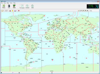
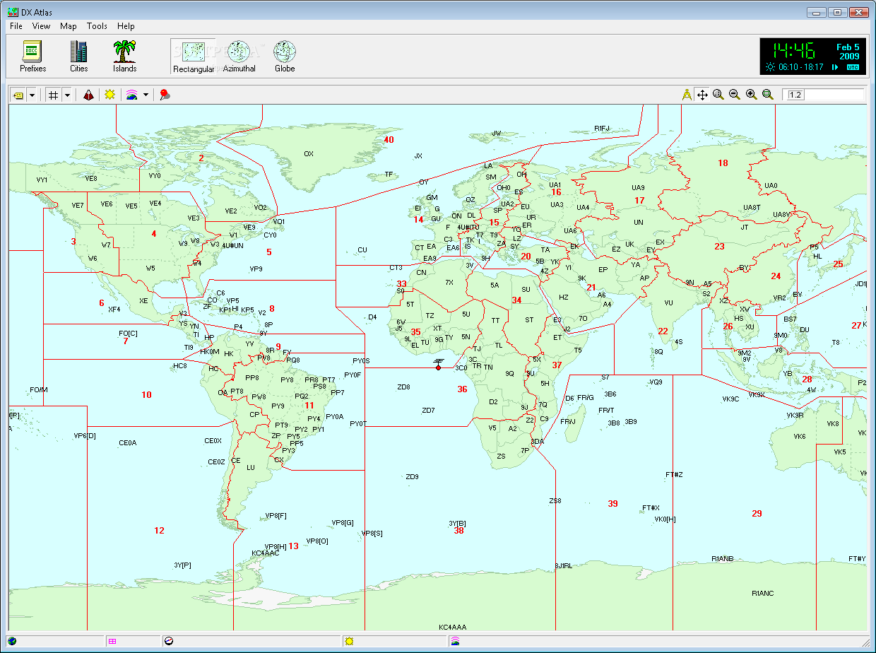
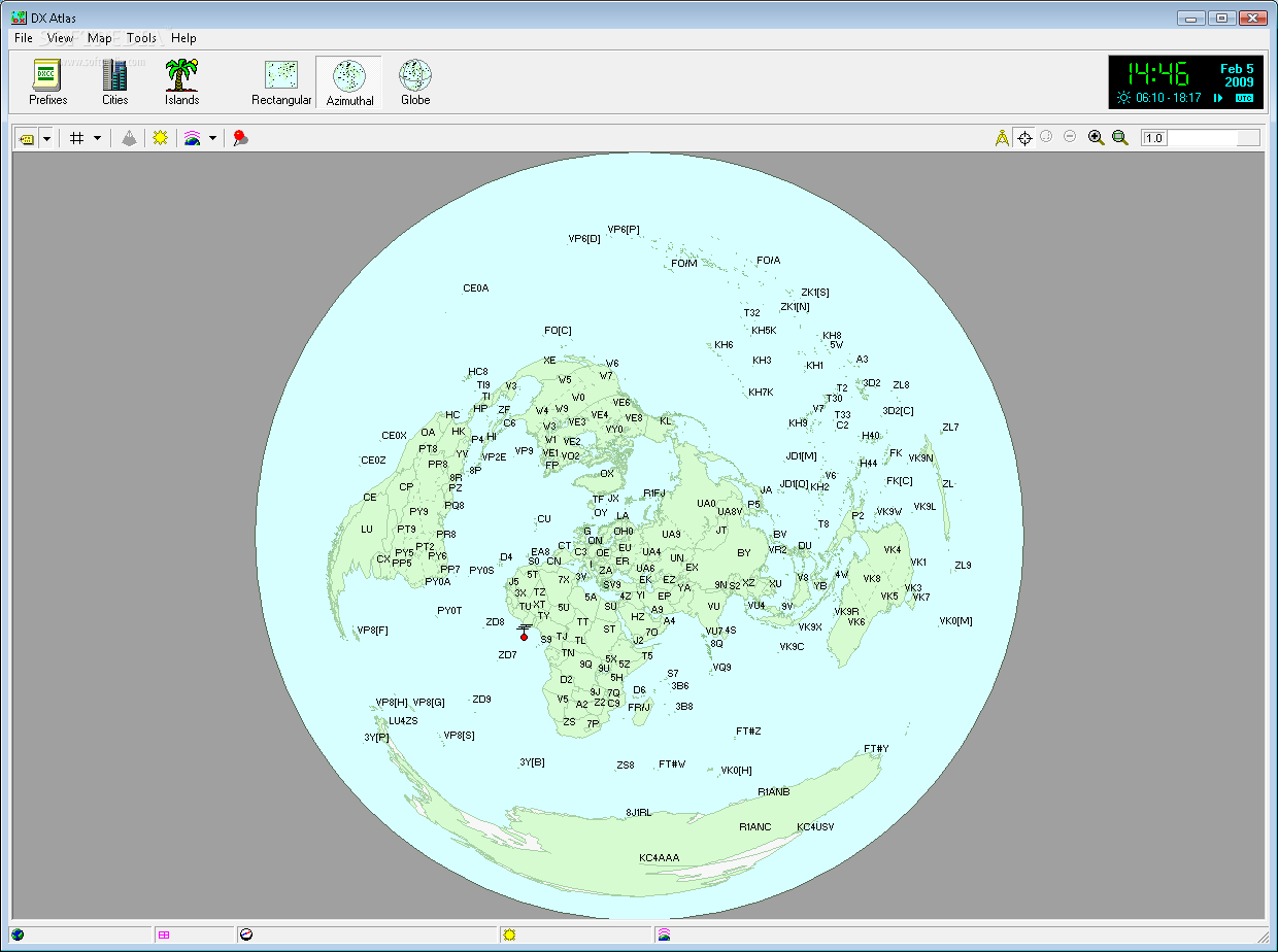
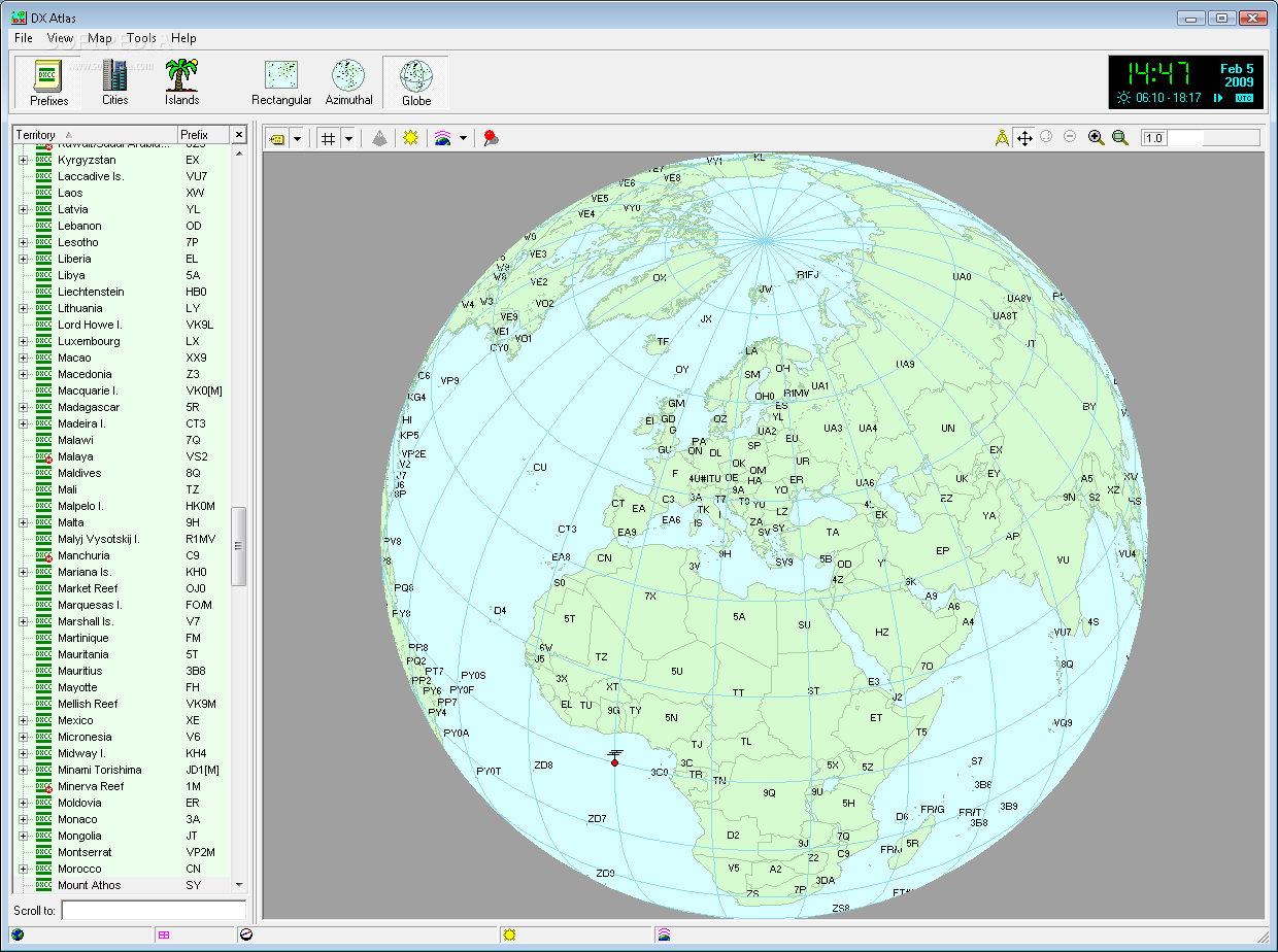
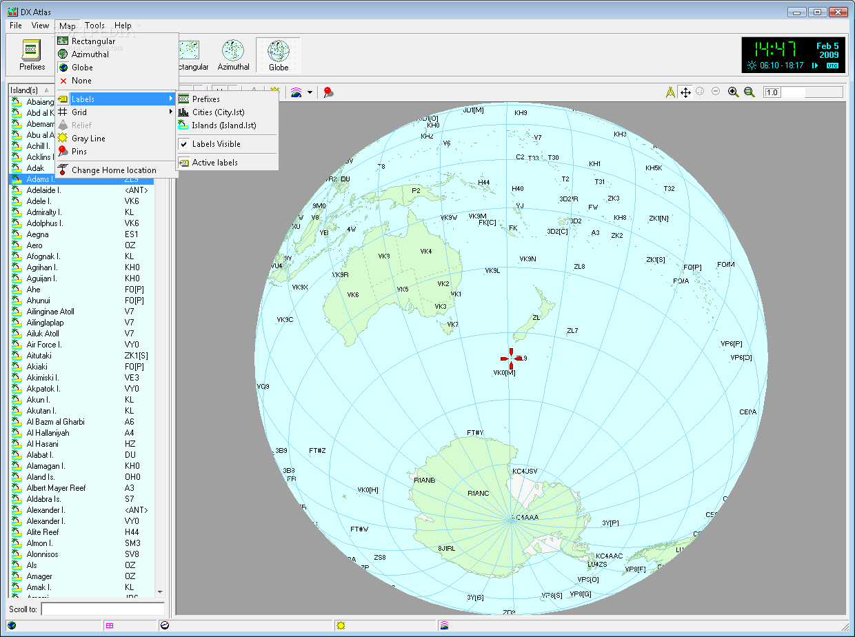
DX Atlas is a lightweight Windows application whose purpose is to help radio amateurs view a world map that contains information about the DXCC territories, state and province prefixes, as well as CQ and ITU Zones.
It sports a clean and straightforward layout that allows you to carry out most operations with minimum effort.
The program gives you the possibility to switch between three different viewing modes, namely rectangular display, azimuth, or globe, zoom in or out, and switch to a full screen mode for a better focus on your work.
DX Atlas offers a detailed list with prefixes for territories, cities, and islands, and helps you locate the selected prefix on the map with a simple double-click on the desired location.
You can select a home location, and the antenna and distance parameters are automatically calculated (short and long path) to the current point on the map and in the indexes, as well as check the local time for all territories, provinces, and cities.
What’s more, you can stick pins on different locations, adjust the color of the map for various parameters, such as water, land, small islands, cities, borders, labels, squares, and others, pick the measurement unit, and alter the relief contrast and shadows.
Other notable characteristics worth mentioning are represented by the possibility to export the map to BMP file format, reveal only the relief, display only the ionospheric and geomagnetic data, as well as hide or show the grid lines.
During our testing we have noticed that DX Atlas carries out a task quickly and provides very good image quality. It doesn’t eat up a lot of CPU and memory, so the overall performance of the computer is not hampered.
All in all, DX Atlas proves to be a reliable application that comes bundled with a decent feature pack, and is suitable for rookies and professionals alike.


 Windows 7 and above
 View Screenshots(4)
 Comments
 Download


 Similar Software
 Recently Searched
 Software Categories
 Trending Software

 Like Us


