Works on: Windows 10 | Windows 8.1 | Windows 8 | Windows 7 | Windows XP | Windows 2000 | Windows 2003 | Windows 2008 | Windows Vista | Windows 2012 SHA1 Hash: 07c05a1063d2f68148a14b9070e53ee65c5ebaed Size: 3.18 MB File Format: zip
Rating: 2.260869565
out of 5
based on 23 user ratings
Publisher Website: External Link Downloads: 1496 License: Free
Earth3D is a free software by Dominique Andre Gunia and works on Windows 10, Windows 8.1, Windows 8, Windows 7, Windows XP, Windows 2000, Windows 2003, Windows 2008, Windows Vista, Windows 2012.
You can download Earth3D which is 3.18 MB in size and belongs to the software category Science CAD. Earth3D was released on 2013-08-17 and last updated on our database on 2017-03-29 and is currently at version 1.
Thank you for downloading from SoftPaz! Your download should start any moment now. It would be great if you could rate and share:
Rate this software:
Share in your network:
Earth3D Description
With the help of Earth3D you can view the globe in 3D mode, as well as zoom in to get a better perspective on a location. It doesn't include complicated options and lets you import other links with satellite images.
The app is portable, so you can run the executable file on any workstation from any source, whether it's the local hard drive, USBÂ flash disk or other removable drive. What's more, no traces are left on the disk after removing the utility, and no new entries are added to the Windows registry.
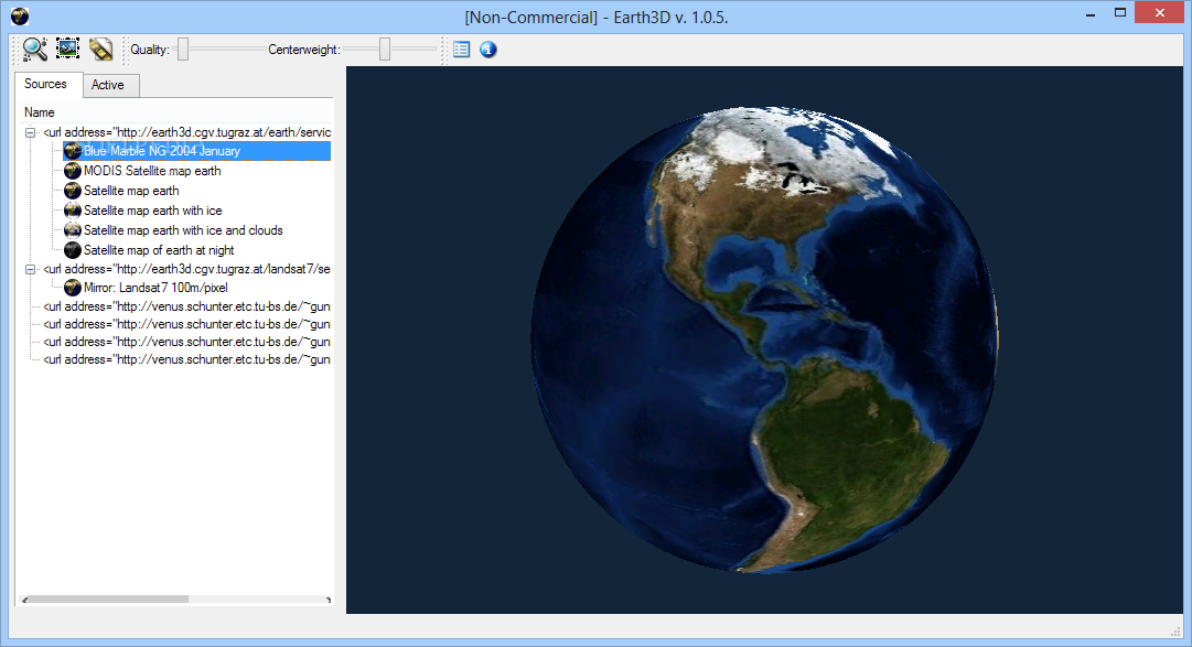
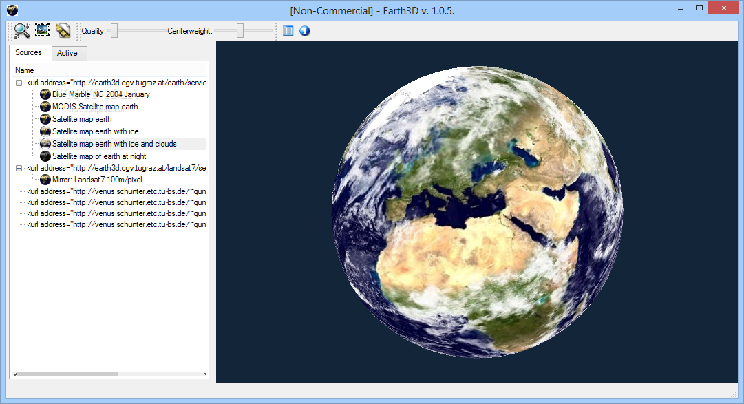
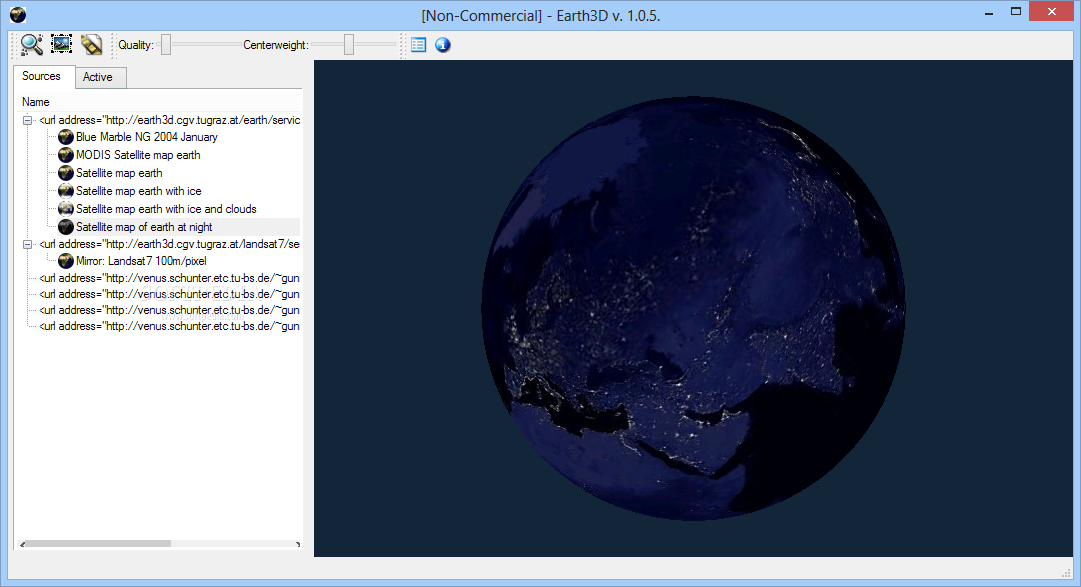
The interface is made from a regular window with two tabs dedicated to source maps and the active one. You can double-click any source in the list to view Earth (e.g. with ice, with ice and clouds, at night), as well as add a new source from a market place or by inserting a link.
You can take screenshots, analyze texture in a separate panel, get GPS coordinates on a selected location, as well as check marker details in the status bar.
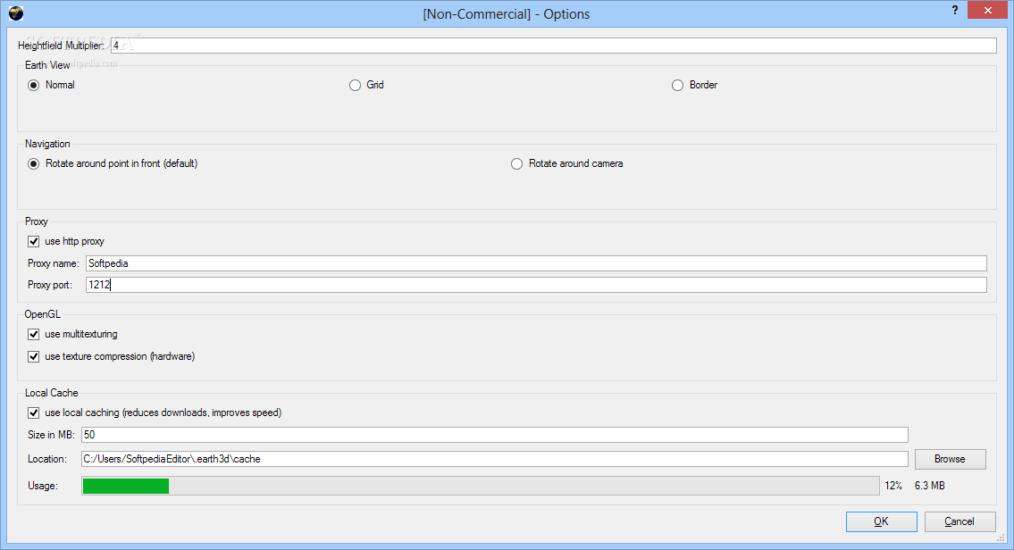
It is possible to adjust the quality and centerweight of the map, change the Earth view (normal, grid, or border), use proxies, multi-texturing, texture compression, and local caching (improves speed while reducing downloads), as well as modify the size and directory of the local cache.
The tool has a fair response time and uses a high amount of system resources. However, it takes a long time to clarify enhanced images and doesn't do a very good job in the end. Clearly, Earth3D cannot be compared to other, more powerful geographical information applications (like Google Earth), but we must also take into account that it has not been updated for a very long time.


 Windows XP and above
 View Screenshots(4)
 Comments
 Download


 Similar Software
 Recently Searched
 Software Categories
 Trending Software

 Like Us


