Works on: Windows 10 | Windows 8.1 | Windows 8 | Windows 7 | Windows XP | Windows 2000 | Windows 2003 | Windows 2008 | Windows Vista | Windows 2012 SHA1 Hash: 7095255047c91c0ebc2b16fcca8e0d1c1df8a38c Size: 47.2 MB File Format: exe
Rating: 2.52173913
out of 5
based on 23 user ratings
Publisher Website: External Link Downloads: 1520 License: Demo / Trial Version
Elevation Mapper is a demo software by dB Foresight and works on Windows 10, Windows 8.1, Windows 8, Windows 7, Windows XP, Windows 2000, Windows 2003, Windows 2008, Windows Vista, Windows 2012.
You can download Elevation Mapper which is 47.2 MB in size and belongs to the software category Science CAD. Elevation Mapper was released on 2014-11-27 and last updated on our database on 2017-04-04 and is currently at version 3.02.
Thank you for downloading from SoftPaz! Your download should start any moment now. It would be great if you could rate and share:
Rate this software:
Share in your network:
Elevation Mapper Description
Elevation Mapper is a comprehensive and reliable software solution whose main purpose is to assist you in creating elevated geographical maps, which can cover just about any surface on the planet.
Clean and straightforward appearance
Subsequent to a fairly brief and uneventful installation process, you can start working with the application, as it quite simple to handle, making experience in the field more of an advantage rather than a necessity.
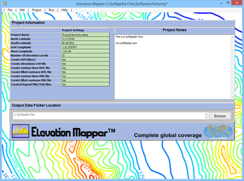
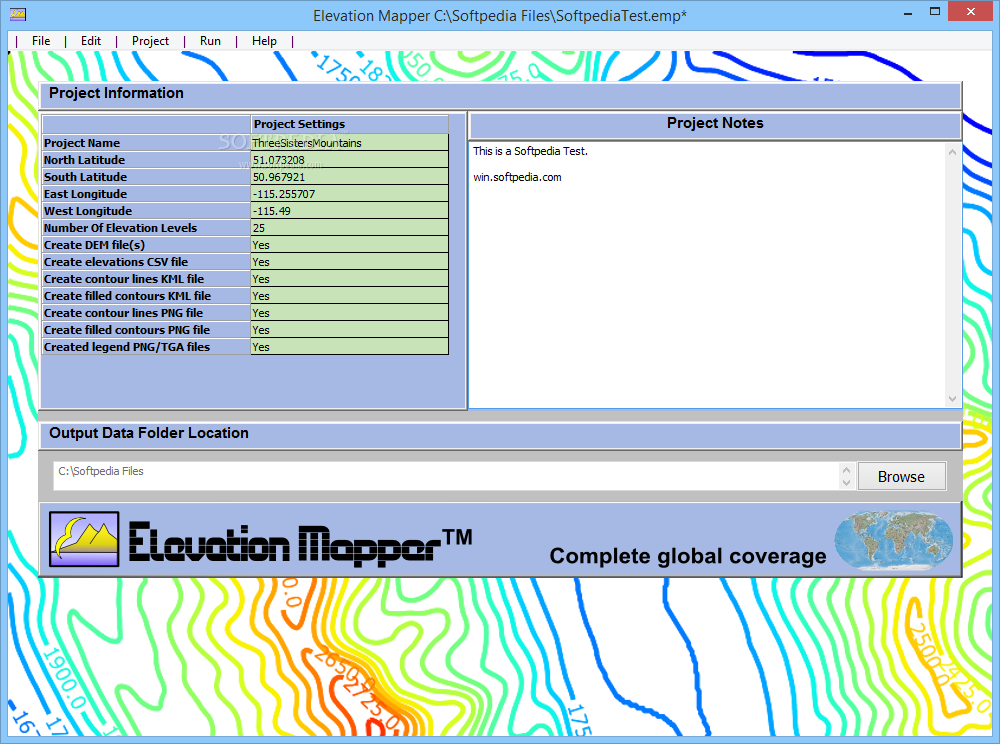
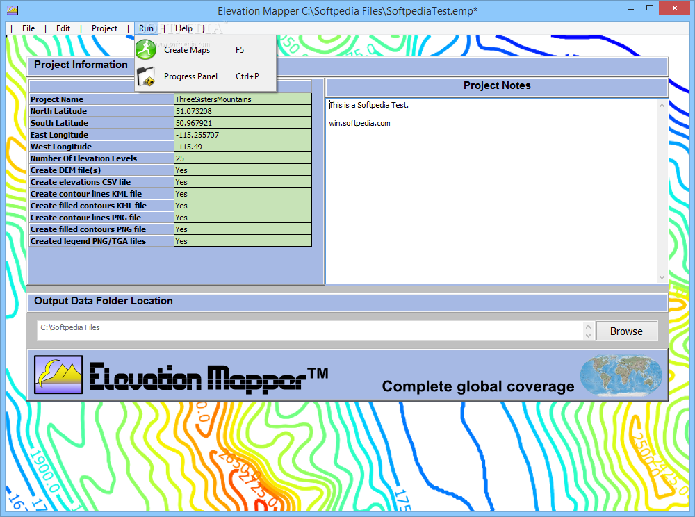
The main window features the project data fields which can be customized according to your needs, while in the ‘Output Data Folder Location’ field, you can choose the destination directory for the generated files.
Enter the coordinates for your location and generate the elevation map
For starters, you will need to configure the ‘Project Settings’, by entering a name for it, then inputting the targeted North, South, East and West coordinates, both for longitude and latitude, in order to specify the area you wish to work on.
You can also add the number of elevation points, then decide whether to create DEM files, CSV elevation documents, KML contour line files, legend PNG/TGA images or PNG and KML filled contour documents, by entering ‘Yes’ or ‘No’ in the appropriate field.
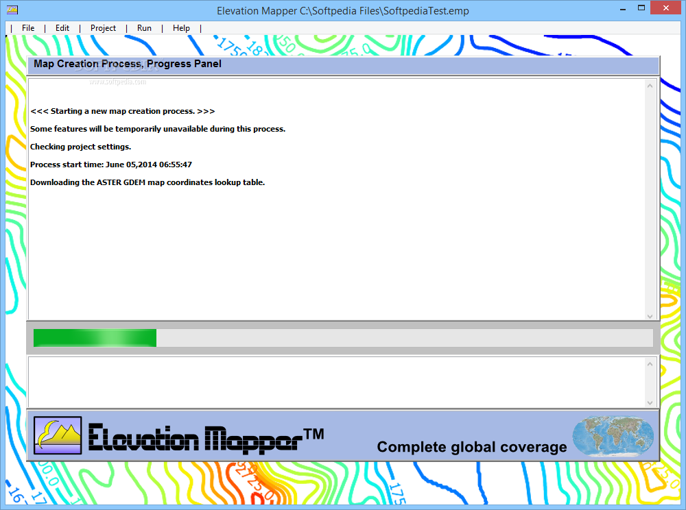
The utility lets you add a series of ‘Project Notes’, after which you can click on the ‘Create Maps’ option from the ‘Run’ menu. After a period during which Elevation Mapper processes the input information, the tool extracts and creates the requested files, saving them to the previously set location, where they can be recovered so you can start working with them.
A handy elevation map builder
Overall, Elevation Mapper proves to be an efficient and user-friendly program that can help you generate elevation maps for any geographically defined area on Earth, just by inputting the corresponding coordinates.


 Windows XP and above
 View Screenshots(6)
 Comments
 Download


 Similar Software
 Recently Searched
 Software Categories
 Trending Software


 Like Us


