Works on: Windows 10 | Windows 8.1 | Windows 8 | Windows 7 | Windows XP | Windows 2000 | Windows 2003 | Windows 2008 | Windows 98 | Windows ME | Windows NT | Windows Vista | Windows 2012 SHA1 Hash: 8ad075c56d8574f4a1fd322841b204dd886a36c0 Size: 342.53 KB File Format: exe
Rating: 2.086956521
out of 5
based on 23 user ratings
Downloads: 1318 License: Free
ESRI Shapefile Extension For BabaCAD is a free software by BabaCAD and works on Windows 10, Windows 8.1, Windows 8, Windows 7, Windows XP, Windows 2000, Windows 2003, Windows 2008, Windows 98, Windows ME, Windows NT, Windows Vista, Windows 2012.
You can download ESRI Shapefile Extension For BabaCAD which is 342.53 KB in size and belongs to the software category Home and Education. ESRI Shapefile Extension For BabaCAD was released on 2015-01-21 and last updated on our database on 2017-04-27 and is currently at version 1.
Thank you for downloading from SoftPaz! Your download should start any moment now. It would be great if you could rate and share:
Rate this software:
Share in your network:
ESRI Shapefile Extension For BabaCAD Description
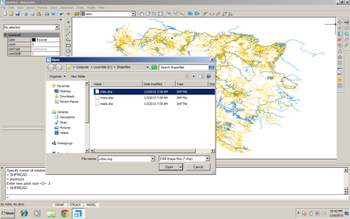
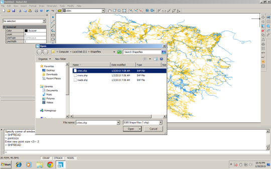
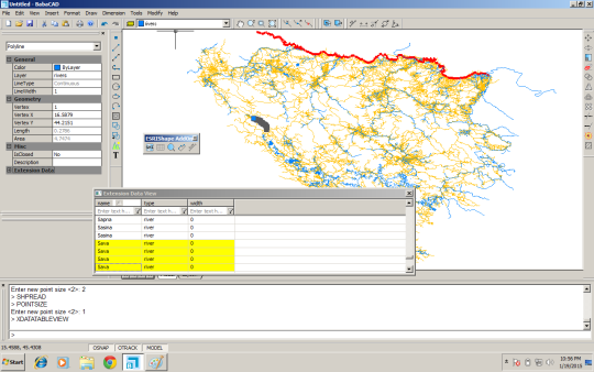
ESRI shapefile editor is enabled with this professional GIS add-on for BabaCAD. Open and edit Esri shape files and attribute data. View attribute data in table view with excel-like auto filter feature. ZoomTo or highlight features based on selected attribute data in Extension Data window. Transform WGS to local coordinate system (Country that use Gauss-Kruger projection currently supported only: Balkan countries, Hungary, Austria, Germany, Finland, Argentina). Calculate sum of line or polyline features using featureslen command. Add-on toolbar automatically installed in BabaCAD after extension setup.


 Windows NT and above
 View Screenshots(2)
 Comments
 Download


 Similar Software
 Recently Searched
 Software Categories
 Trending Software

 Like Us


