Version: 4 Last Updated: 16 Apr 2017 Release: 15 Feb 2012 Category: Programming
Rate this software:
147 downloads
View Screenshots(3)
Comments
Download
Liked it? Tell others:
Eye4Software GPS Toolkit Details
Works on: Windows 10 | Windows 8.1 | Windows 8 | Windows 7 | Windows XP | Windows 2000 | Windows 2003 | Windows 2008 | Windows Vista | Windows 2012 SHA1 Hash: 851ae53c6441cebc9e38ce9c4c963eaa69e30100 Size: 4.35 MB File Format: exe
Rating: 2.565217391
out of 5
based on 23 user ratings
Publisher Website: External Link Downloads: 147 License: Demo / Trial Version
Eye4Software GPS Toolkit is a demo software by Eye4software B.v. and works on Windows 10, Windows 8.1, Windows 8, Windows 7, Windows XP, Windows 2000, Windows 2003, Windows 2008, Windows Vista, Windows 2012.
You can download Eye4Software GPS Toolkit which is 4.35 MB in size and belongs to the software category Programming. Eye4Software GPS Toolkit was released on 2012-02-15 and last updated on our database on 2017-04-16 and is currently at version 4.
Thank you for downloading from SoftPaz! Your download should start any moment now. It would be great if you could rate and share:
Rate this software:
Share in your network:
Eye4Software GPS Toolkit Description
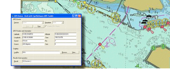
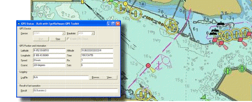
GPS SDK to add GPS and coordinate conversion functionality to your software and scripts). All NMEA0183 protocol versions are supported and can be filtered by NMEA sentence type and talker ID. Garmin USB PVT support. Information on GPS status can also be retrieved: GPS fix quality, satellites used in fix, satellites in view, satellite azimuth, elevation and signal strengths. The toolkit also offers functionality to perform map grid and datum transformations: latitude and longitude can be converted to various map grids, like Transverse Mercator (TM), Oblique Mercator, Mercator, Oblique Stereographic, Polar Stereographic, Cassini, Albers Equal Area Conal, Gauss Kruger or Lambert Conformal Conic projection, Lambert Azimuthal Equal Area and Krovak, for instance, to convert the GPS position to UTM or NAD27 / NAD83 State Plane. All map grid parameters can be specified (Scale Factor, False Northing, False Easting, Origin Latitude, Origin Longitude, North Parallel, South Parallel ) allowing you to convert your position to any map grid around.Comes with various programming examples: Visual C++, Visual Basic, Visual C# .NET, Visual Basic .NET and VBScript. NADCON, HARN and NTv2 datum conversions are supported. The software contains more then 5000 map datums and local map grid definitions.
Where to buy?
Last updated price and discount information 9 years agoupdate now


 Windows 2000 and above
 View Screenshots(3)
 Comments
 Download


 Similar Software
 Recently Searched
 Software Categories
 Trending Software


 Like Us


