Works on: Windows 10 | Windows 8.1 | Windows 8 | Windows 7 | Windows 2012 SHA1 Hash: 70eb0383b54cf109fa712701859292cb919c979b Size: 1.22 MB File Format: zip
Rating: 2.086956521
out of 5
based on 23 user ratings
Publisher Website: External Link Downloads: 309 License: Demo / Trial Version
Geodata Germany is a demo software by C. Killet Software Ing.-gbr and works on Windows 10, Windows 8.1, Windows 8, Windows 7, Windows 2012.
You can download Geodata Germany which is 1.22 MB in size and belongs to the software category Personal Finance. Geodata Germany was released on 2013-10-17 and last updated on our database on 2017-04-17 and is currently at version 17.1.
Thank you for downloading from SoftPaz! Your download should start any moment now. It would be great if you could rate and share:
Rate this software:
Share in your network:
Geodata Germany Description
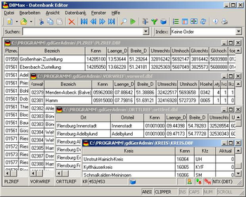
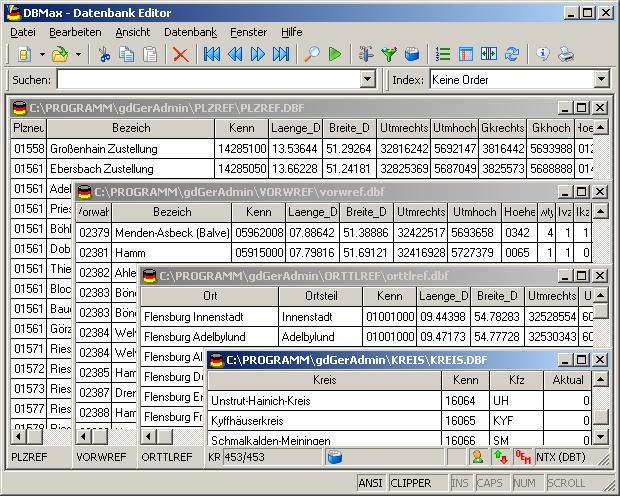
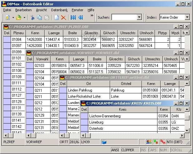
The database tables contains geodata of the Federal Republic of Germany with geo referenced towns, municipalities, town quarters and other administrative units, postal codes, telephone preselections, nature areas, landscapes, climatic zones and official topographical cartographies. The data contain coordinates for navigation and geo-coding, proximity searches and distance computations and are prepered for the spatial mapping of environmental information. Quite often it is necessary to reference an address field e.g. like town or municipality name, postal code or telephone preselection, to corresponding geographical data and coordinates - a Geo Reference. The geo reference can be used e.g. to direct a customer to the closest store locations of a retail store chain by doing a proximity search. Another possibility it to determine distances between the different objects of the database tables with the included geo references. With the elevation data from a Digital Elevation Model the ground level height of each place can be determined. Often the knowledge is necessary about affiliations and relationships between data derived from different hierarchies. So it can be determined to which federal state, governmental area or governmental county a town, a postal code or a telephone preselection is associated. It is possible to assign a variety of natural and scenic information to each town or municipality. The snow and wind load zones and solar irradiation are available as local climatic data. In conjunction with the ground level heights they can be used to calculate static loads for the planning of building constuctions and to calculate solar installations. Databases: 11.000 Towns and Municipalities, 108.000 Town Quarters, 30.000 Postal Codes, 19.000 Telephone Preselections, all with geo references, 400 Administrative Countys, Administrative Districts, Federal States of Germany, Landscapes, Nature Area Classification, Snow and Wind Load Zones, Solardata, Cartographies.
Where to buy?
Last updated price and discount information 9 years agoupdate now


 Windows 7 and above
 View Screenshots(3)
 Comments
 Download


 Similar Software
 Recently Searched
 Software Categories
 Trending Software

 Like Us


