Works on: Windows 10 | Windows 8.1 | Windows 8 | Windows 7 | Windows 2012 SHA1 Hash: 4be6b2db88c9d56e50232294b7b166f551c74e54 Size: 2.07 MB File Format: zip
Rating: 2.260869565
out of 5
based on 23 user ratings
Publisher Website: External Link Downloads: 548 License: Demo / Trial Version
GeoData International (English) is a demo software by Killet Softwareentwicklung GbR and works on Windows 10, Windows 8.1, Windows 8, Windows 7, Windows 2012.
You can download GeoData International (English) which is 2.07 MB in size and belongs to the software category Servers. GeoData International (English) was released on 2017-02-26 and last updated on our database on 2017-06-13 and is currently at version 9.01.
Thank you for downloading from SoftPaz! Your download should start any moment now. It would be great if you could rate and share:
Rate this software:
Share in your network:
GeoData International (English) Description
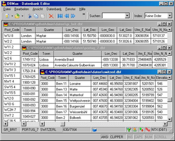
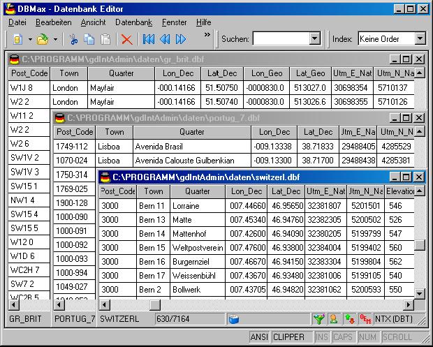
Geodata International is a comprehensive and useful database that contains a plethora of geographic and GIS-related information for almost all countries in the world, including towns, municipalities, distractions, localities, their zip codes and GPS, WGS84, and UTM coordinates.
Straight from the get-go, it becomes quite evident that this database has a broad spectrum of applications and it can be especially useful when it comes to developing geocoding, data enrichment, distance calculation, proximity search and even navigation utilities.
Before anything else, it is worthy to point out that the bundled geodata is by no means from open-source data. In fact, the geodata is actually recorded from official resident authorities, various institutions, and Geodata International suppliers.
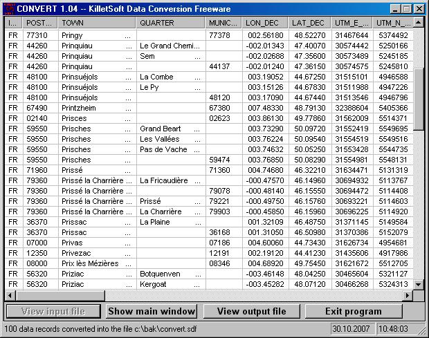
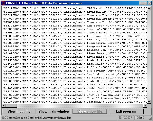
On that note, you should be able to effortlessly integrate it within your software projects since it is composed out of CSV, SDF and Xbase files in UTF8 format files. Its content is neatly organized within various Country Groups, as follows: Germania/Austria/Switzerland, Germany + Neighbors, West Europe, East Europe, Pan Europe, North America, Central America + the Caribbean, South America, Australia-Asia + Pacific, Asia, Middle East, Africa and Worldwide.
Furthermore, distances between various places can or postal areas can be calculated with the coordinates contained in the database tables, which are expressed in longitude and latitude. What is more, the database can also be used for apps that require calculations of level height.
To conclude, Geodata International is a lightweight collection of worldwide geographical and administrative data that can be easily integrated within multiple utilities.Limitations in the unregistered versionNot all the country names are available in demo mode
Where to buy?
Last updated price and discount information 9 years agoupdate now


 Windows 7 and above
 View Screenshots(3)
 Comments
 Download


 Similar Software
 Recently Searched
 Software Categories
 Trending Software

 Like Us


