Works on: Windows 10 | Windows 8.1 | Windows 8 | Windows 7 | Windows 2012 SHA1 Hash: 9d8a79985cb83474dc4e238458c30e05f8ae086c Size: 61.35 MB File Format: msi
Rating: 3.0384615384615
out of 5
based on 26 user ratings
Publisher Website: External Link Downloads: 4870 License: Free
GFS-view is a free software by BadProgrammer and works on Windows 10, Windows 8.1, Windows 8, Windows 7, Windows 2012.
You can download GFS-view which is 61.35 MB in size and belongs to the software category Science CAD. GFS-view was released on 2017-09-19 and last updated on our database on 2017-09-19 and is currently at version 0.05.
Thank you for downloading from SoftPaz! Your download should start any moment now. It would be great if you could rate and share:
Rate this software:
Share in your network:
GFS-view Description
GFS-view is a lightweight piece of software that helps you create comprehensive weather forecast maps using data from National Centers for Environmental Prediction or NCEP.
Apart from making sure that Microsoft Visual C++ Redistributable Package 2015 is present on your computer's system, you need to undergo a relatively simplistic, wizard-based installation process in order to deploy this app.
Fairly easy to get started with
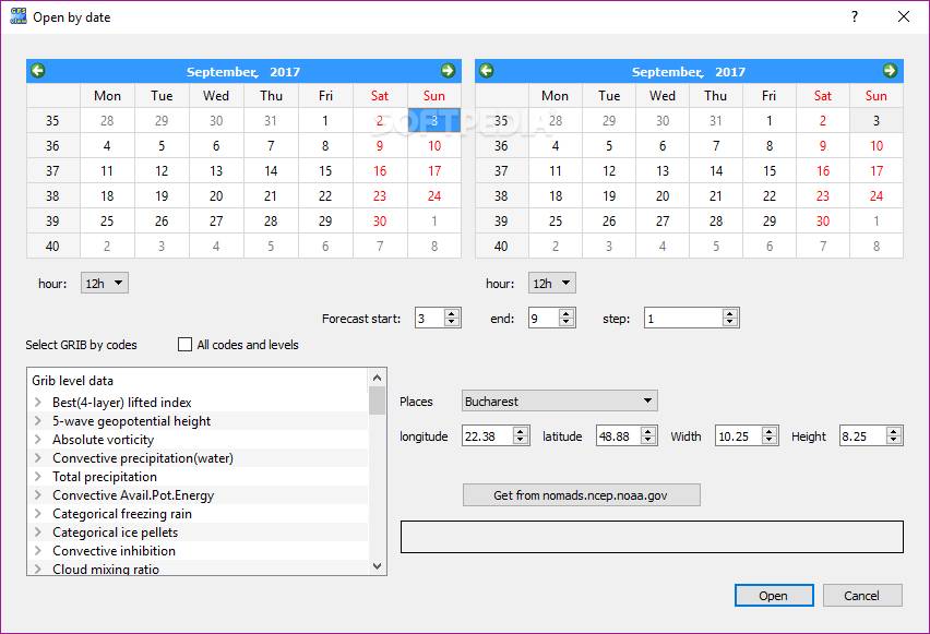
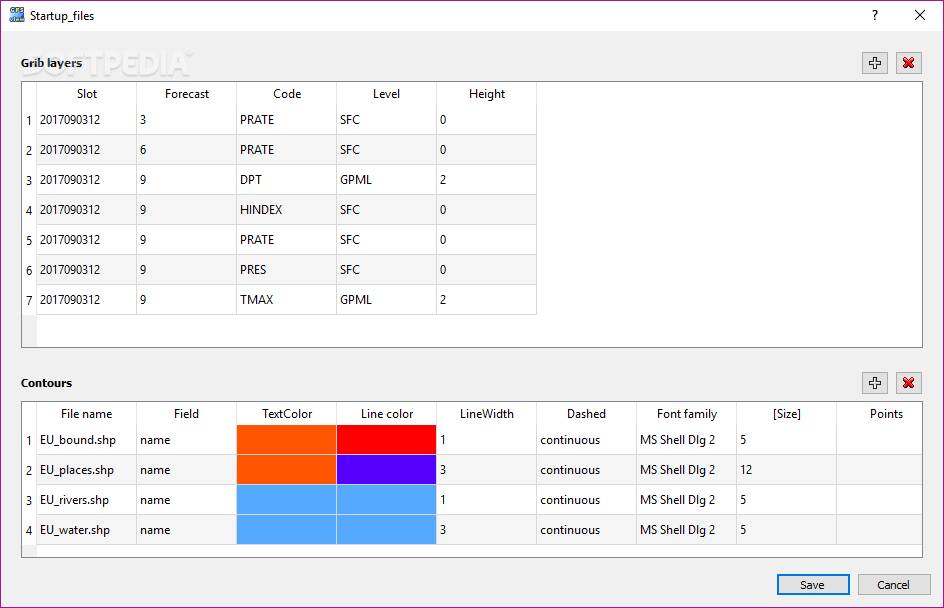
That said, simply launch the program and start off by downloading GRIB2 data. Click the Open by date button and from the two calendar panels, select the start and end dates and the GRIB by codes, or choose to check the "All codes and levels" option.
Continue by selecting the starting run time and ending run time from the designated sections, as well as the region of interest from the Places list. It's also worth pointing out that you should also set the area size in decimal degrees.
Click the "Open" or the designated button for getting the data from NCEP (NOMADS) hosts, and once the downloads are completed, you should be ready to start taking advantage of everything this app has to offer.
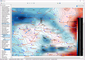
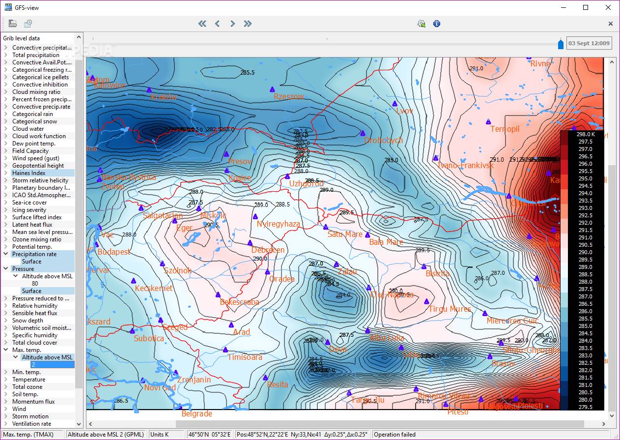
Simple yet efficient app for creating forecast maps with NCEP data
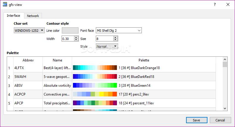
For instance, you can load shape-file maps and overlay them on your current forecast map, zoom and scroll the whole assembly for more details, and customize the appearance of your map by choosing the color table and font size.
You can also generate maps for specific periods from GRIB codes, and based on the level and height.
Effortlessly create weather forecast maps
Taking everything into account, GFS-view is a useful utility that surely comes in handy for users interested in creating weather forecast maps. The app sports a minimalist set of features, packed within an uncomplicated UI but, we have to say that it does require a bit of getting used to.
Since there's no user manual included, your best bet when it comes to learning how this app works is the Quick start guide from the app's official website.


 Windows 7 and above
 View Screenshots(5)
 Comments
 Download


 Similar Software
 Recently Searched
 Software Categories
 Trending Software
 Like Us


