Works on: Windows 10 | Windows 8.1 | Windows 8 | Windows 7 | Windows 2012 SHA1 Hash: dace7efdf1c34962edd3098b1a0cc2a7d1a62729 Size: 6.16 MB File Format: zip
Rating: 2
out of 5
based on 23 user ratings
Downloads: 439 License: Free
GPStamper Geotagger is a free software by Michael G. Lee and works on Windows 10, Windows 8.1, Windows 8, Windows 7, Windows 2012.
You can download GPStamper Geotagger which is 6.16 MB in size and belongs to the software category Graphic. GPStamper Geotagger was released on 2011-11-23 and last updated on our database on 2017-03-03 and is currently at version 1.5.
Thank you for downloading from SoftPaz! Your download should start any moment now. It would be great if you could rate and share:
Rate this software:
Share in your network:
GPStamper Geotagger Description
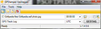
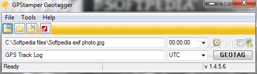
GPStamper Geotagger uses ExifTool to simply and efficiently geotag your images. Geotag the following eight EXIF tags: GPSLatitude, GPSLatitudeRef, GPSLongitude, GPSLongitudeRef, GPSAltitude, GPSAltitudeRef, GPSDateStamp and GPSTimeStamp.
Select the file or folder to geotag, the GPS log and timezone where the images were taken, then click “Geotagâ€. A copy of the file is geotagged (unless the “overwrite originals†checkbox is ticked).
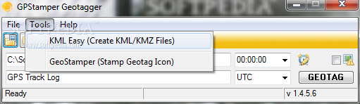
KML/KMZ file creation using KML Easy, and Geotag Icon stamping using GeoStamper (both included) are also possible immediately after geotagging, or you can reload any geotagged files or folders for later processing.
If the camera clock was not set precisely, file times can be adjusted using the “Adjust Time†feature. Adjusting file times will increase the accuracy of the geotagging. Now ncludes the new “Geosync†feature of ExifTool.
Reverse Geotag (obtain location description for GPS position) immediately after geotagging with no further user input required! Confirm the success of the geotagging process utilitizing the “View GPS Metadata†feature.
Take GPStamper Geotagger for a spin to see just how useful it can actually be for you!


 Windows 7 and above
 View Screenshots(2)
 Comments
 Download


 Similar Software
 Recently Searched
 Software Categories
 Trending Software
 Like Us


