Works on: Windows 10 | Windows 8.1 | Windows 8 | Windows 7 | Windows XP | Windows 2000 | Windows 2003 | Windows 2008 | Windows Vista | Windows 2012 SHA1 Hash: 1c3817fa8419f330a9b26a771c2b605bdaffce48 Size: 52.64 MB File Format: msi
Rating: 2.130434782
out of 5
based on 23 user ratings
Publisher Website: External Link Downloads: 1623 License: Demo / Trial Version
Map Suite GIS Editor is a demo software by ThinkGeo and works on Windows 10, Windows 8.1, Windows 8, Windows 7, Windows XP, Windows 2000, Windows 2003, Windows 2008, Windows Vista, Windows 2012.
You can download Map Suite GIS Editor which is 52.64 MB in size and belongs to the software category WEB Design. Map Suite GIS Editor was released on 2013-01-15 and last updated on our database on 2017-04-25 and is currently at version 1.
Thank you for downloading from SoftPaz! Your download should start any moment now. It would be great if you could rate and share:
Rate this software:
Share in your network:
Map Suite GIS Editor Description
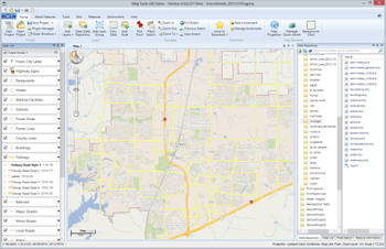
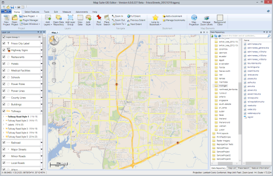
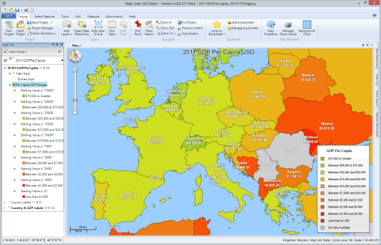
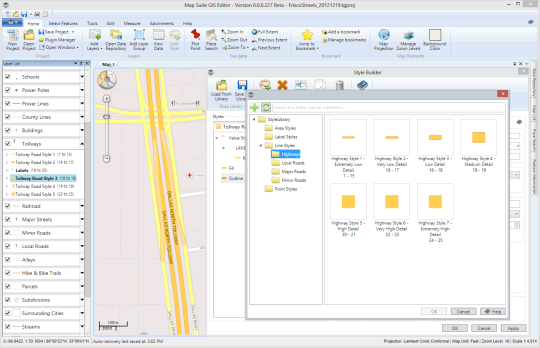
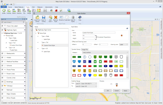
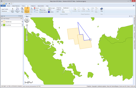
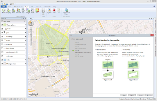
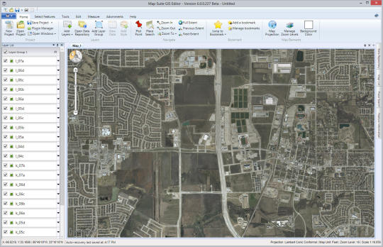
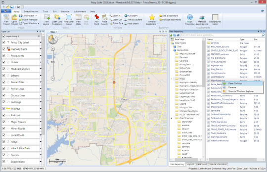
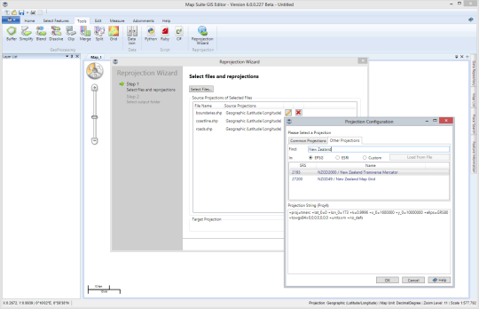
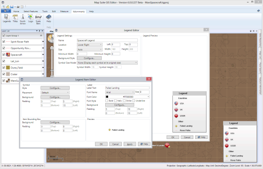
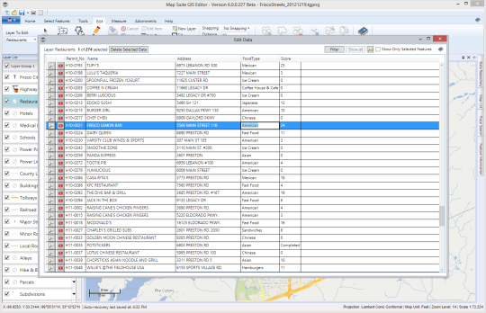
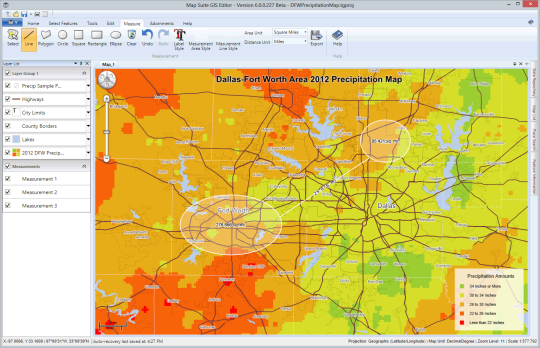
he Map Suite GIS Editor for Windows lets you design stunning maps, perform geo-analysis and visualize your data. Powerful enough for professional GIS technicians yet accessible enough for nearly anyone who needs to create a map, the GIS Editor is designed as a single-application solution to all of your GIS visualization needs. And with its affordable subscription model, you can harness the full power of professional GIS for as little as $49.95 per month.You can use the Map Suite GIS Editor to: - Quickly build maps using simple and intuitive tools - Visualize data, statistics and trends geographically - Design, style and label rich and detailed maps - Integrate data from a variety of sources, including Web Map Services - Draw right on the map, edit and create feature data - Make your maps publication-ready with titles, legends and annotationsYou can do all of this without wading through stacks of cryptic toolbars or scouring nested menus. The GIS Editors simple ribbon bar interface puts its full complement of GIS tools at your fingertips in an easy-to-understand way. Wizards make short work of batch geoprocessing, geocoding and reprojection operations. And with the built-in Data Repository, you can keep all of your data close at hand, regardless of where it lives.
Where to buy?
Last updated price and discount information 9 years agoupdate now


 Windows XP and above
 View Screenshots(12)
 Comments
 Download


 Similar Software
 Recently Searched
 Software Categories
 Trending Software


 Like Us


