Works on: Windows 10 | Windows 8.1 | Windows 8 | Windows 7 | Windows XP | Windows 2000 | Windows 2003 | Windows 2008 | Windows Vista | Windows 2012 SHA1 Hash: 2dbb36d2c9b39dc5f16da651c35f24456323fbef Size: 2.84 MB File Format: zip
Rating: 2.260869565
out of 5
based on 23 user ratings
Publisher Website: External Link Downloads: 1206 License: Demo / Trial Version
PowerPoint Worldmap is a demo software by Stallwanger IT.dev and works on Windows 10, Windows 8.1, Windows 8, Windows 7, Windows XP, Windows 2000, Windows 2003, Windows 2008, Windows Vista, Windows 2012.
You can download PowerPoint Worldmap which is 2.84 MB in size and belongs to the software category Business. PowerPoint Worldmap was released on 2013-08-01 and last updated on our database on 2017-04-26 and is currently at version 2.01.
Thank you for downloading from SoftPaz! Your download should start any moment now. It would be great if you could rate and share:
Rate this software:
Share in your network:
PowerPoint Worldmap Description
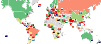
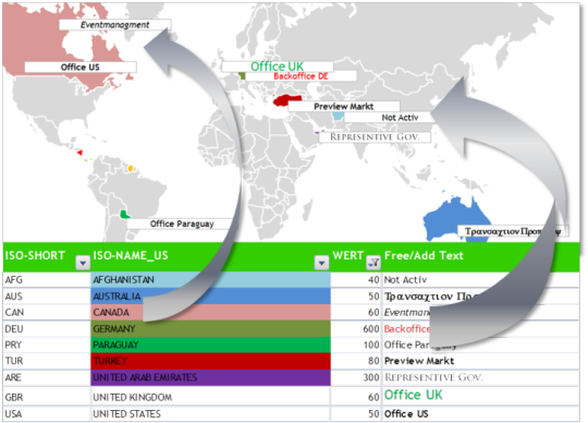
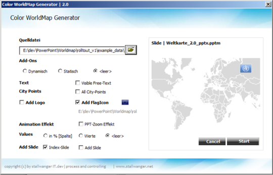
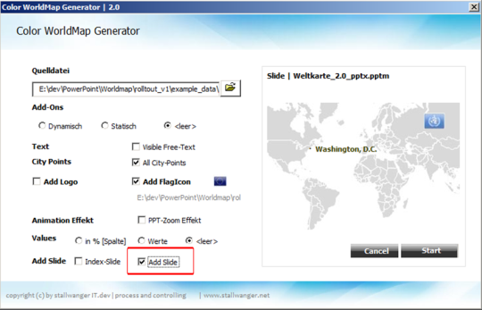
The Color-World Map Generator is an extremely efficient tool which allows you to edit and manage your data in an excel table and enables you to easily adapt and visualize the data in a PowerPoint Presentation.The Color-World Map Generator is a helpful tool that automates the cumbersome manual insertion of text elements, shapes and animation effects in PowerPoint.Numerous useful features such as country codes and ISO flags are installed in the sub-directories. The flag symbols, in various sizes, can be placed in exact positions on your PowerPoint World Map.In addition you can insert your Company Logo and other pictures, even add a Weblink, which you can simply open using your Web-Browser during your presentationColor Scheme:The color adaption of the maps is playfully simple to do and can be easily tailored to your CI guidelines.The World MAP Generator simply adopts fond color, size, style and effects (bold, cursive, underlined) from your excel template and transfers them in to yourPowerPoint Presentation.Presenting your Data on the Map or in newly created slides:You can show your data and figures directly on the Map and/or for a better overview create additional slides where you can enhance your data and give a more detailed summary of your figures and analyses.
Where to buy?
Last updated price and discount information 9 years agoupdate now


 Windows XP and above
 View Screenshots(4)
 Comments
 Download


 Similar Software


 Recently Searched
 Software Categories
 Trending Software


 Like Us


