Works on: Windows 10 | Windows 8.1 | Windows 8 | Windows 7 | Windows XP | Windows 2000 | Windows 2003 | Windows 2008 | Windows Vista | Windows 2012 SHA1 Hash: a06354e721c441f6f0f721e326506450e8488dd6 Size: 21.91 MB File Format: zip
Rating: 1.913043478
out of 5
based on 23 user ratings
Downloads: 387 License: Demo / Trial Version
Tiles2kml Pro is a demo software by Tiles2kml and works on Windows 10, Windows 8.1, Windows 8, Windows 7, Windows XP, Windows 2000, Windows 2003, Windows 2008, Windows Vista, Windows 2012.
You can download Tiles2kml Pro which is 21.91 MB in size and belongs to the software category Graphic. Tiles2kml Pro was released on 2007-03-24 and last updated on our database on 2017-02-19 and is currently at version 2.31.
Thank you for downloading from SoftPaz! Your download should start any moment now. It would be great if you could rate and share:
Rate this software:
Share in your network:
Tiles2kml Pro Description
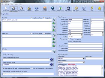
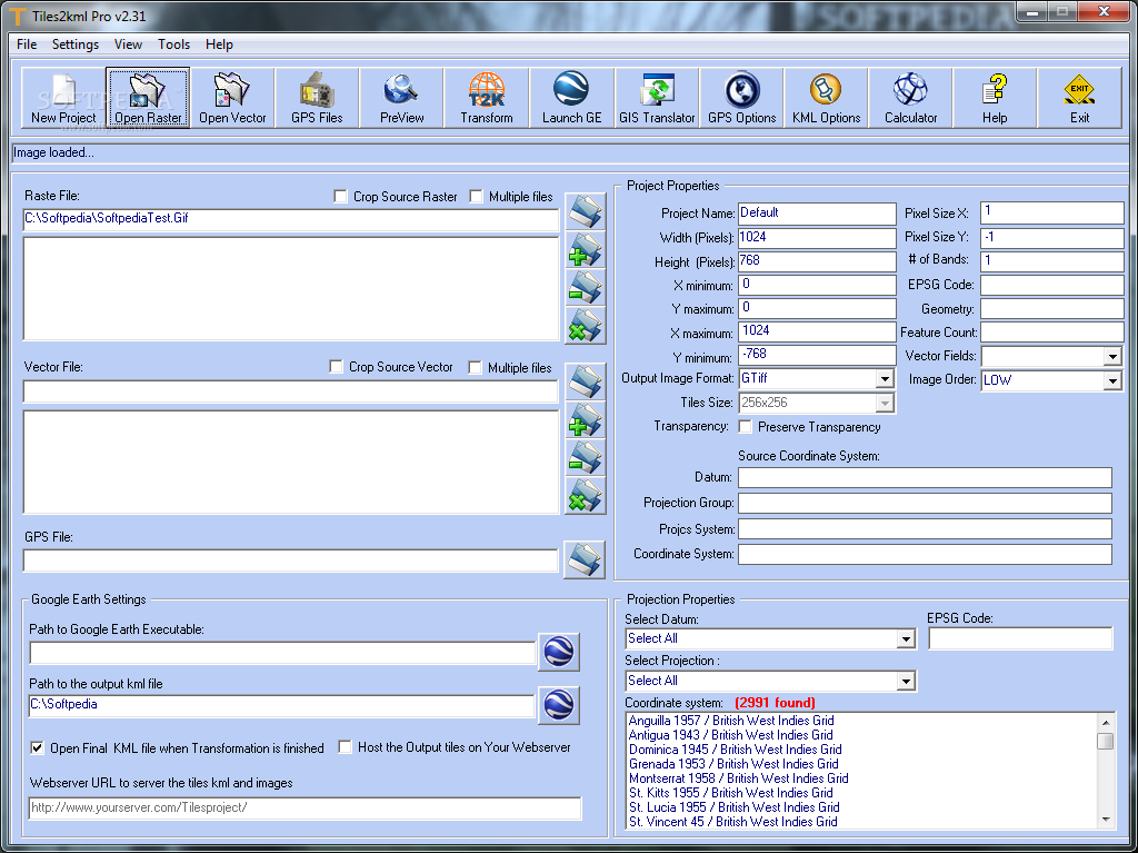
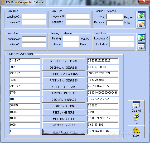
T2K Pro integrates the rich world of GIS datasets and transfers your Geographic information data into Google Earth. T2K Pro can handle rich data types and access large volumes of geographic data stored in files and databases, T2K can handle raster (imagery), Vector Map data and GPS Tracks/ Waypoints/ Routes. Tiles2kml Pro v2.31 provides a complete suite of conversion tools to easily visualize and convert your existing geospatial data.
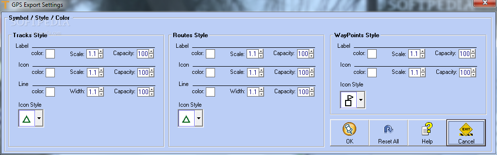
· GPS Supported Formats:
Cambridge/Winpilot glider software (*.dat)
CarteSurTable data file (*.cst)
Cetus for Palm/OS (*.pdb)
CoastalExplorer XML (*.xml)
Comma separated values (*.csv)
CompeGPS data files (*.wpt/trk/rte)
CoPilot Flight Planner for Palm/OS (*.pdb)
cotoGPS for Palm/OS (*.pdb)
Dell Axim Navigation System (*.gpb)
DeLorme .an1 drawing (*.an1)
DeLorme GPL (*.gpl)
DeLorme Street Atlas Route (*.txt)
DeLorme XMap HH Native (*.wpt)
DeLorme XMap/SAHH 2006 Native (*.txt)
DeLorme XMat HH Street Atlas USA (PPC)(*.wpt)
EasyGPS binary format (*.loc)
FAI/IGC Flight Recorder Data Format (*.igc)
Franson GPSGate Simulation (*.gps)
Fugawi (*.txt)
Garmin 301 Custom position and heartrate (*.txt)
Garmin Logbook XML (*.xml)
Garmin MapSource (*.gdb)
Garmin MapSource (*.mps)
Garmin MapSource (tab delimited)(*.txt)
Garmin PCX5 (*.pcx)
Garmin POI database (*.csv)
Garmin Training Centerxml (*.xml)
Geocaching (*.loc)
GeocachingDB for Palm/OS (*.pdb)
GEOnet Names Server (GNS)(*.txt)
GeoNiche (*.pdb)
Google Earth Keyhole Markup Language (*.kml)
GpilotS (*.pdb)
GPS TrackMaker (*.gtm)
GPSBabel arc filter file (*.txt)
GpsDrive Format (*.csv)
GpsDrive Format for Tracks (*.txt)
GPSman (*.txt)
GPSPilot Tracker for Palm/OS (*.pdb)
gpsutil (*.txt)
GPX XML (*.gpx)
HikeTech (*.gps)
Holux (gm-100)
Format (*.wpo)
HSA Endeavour Navigator export File (*.exp)
HTML Output (*.html)
IGN Rando track files (*.rdn)
Kartex 5 Track File (*.ktf)
Kartex 5 Waypoint File (*.kwf)
KuDaTa PsiTrex text (*.txt)
Lowrance USR (*.usr)
Magellan Explorist Geocaching (*.gs)
Magellan Mapsend (*.trk)
Magellan NAV Companion for Palm/OS (*.pdb)
Magellan SD files (*.upt)
Magellan serial protocol (*.upt)
Mapopolis.com Mapconverter CSV (*.csv)
MapTech Exchange Format (*.mxf)
Microsoft AutoRoute 2002 (*.txt)
Microsoft Streets and Trips (*.txt)
Microsoft Streets and Trips (*.txt)
Motorrad Routenplaner (Map and Guide) (*.bcr)
MS PocketStreets 2002 Pushpin (*.psp)
National Geographic Topo (*.tpg)
National Geographic Topo 2.x (*.tpo)
National Geographic Topo 3.x/4.x (*.tpo)
Navicache.com XML (*.xml)
Navigon Mobile Navigator (*.rte)
Navitrak DNA marker format (*.dna)
NetStumbler Summary File (*.txt)
NIMA/GNIS Geographic Names File (*.txt)
NMEA 0183 sentences (*.txt)
OziExplorer (*.wpt/plt/rte)
PalmDoc Output (*.pdb)
PathAway Database for Palm/OS (*.pdb)
Quovadis (*.pdb)
See You flight analysis data (*.cup)
Sportsim track files (*.txt)
Suunto Trek Manager (*.sdf)
Suunto Trek Manager WaypointPlus (*.txt)
Tab delimited fields (*.txt)
Textual Output (*.txt)
TomTom POI file (*.ov2)
TopoMapPro Places File (*.tmpro)
TrackLogs digital mapping (*.trl)
U.S. Census Bureau Tiger Mapping Service (*.txt)
Universal csv (*.csv)
Vcard Output for iPod (*.vcf)
Vito Navigator II tracks (*.smt)
WiFiFoFum 2.0 for PocketPC XML (*.xml)
Wintec WBT-100/200 Binary file format (*.bin)
Wintec WBT-100/200 GPS Download (*.wbt)
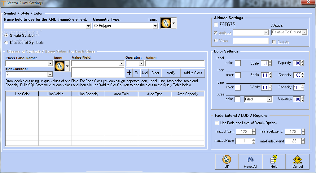
· Vector Supported Formats
AutoCAD DXF (*.DXF)
ESRI Shape (*.SHP)
MapInfo datasets (*.TAB)
MapInfo (*.MIF)
Geography Markup Language (*.GML)
Keyhole Markup Language (*.KML)
Keyhole Markup Language Zipped (*.KMZ)Limitations in the unregistered version10 days trial
Nag screen
Where to buy?
Last updated price and discount information 9 years agoupdate now


 Windows XP and above
 View Screenshots(4)
 Comments
 Download


 Similar Software
 Recently Searched
 Software Categories
 Trending Software


 Like Us


