Works on: Windows 10 | Windows 8.1 | Windows 8 | Windows 7 | Windows XP | Windows 2000 | Windows 2003 | Windows 2008 | Windows Vista | Windows 2012 SHA1 Hash: 7d2bd0f2164d9394496d85cf553cff132fbd94a2 Size: 17.86 MB File Format: zip
Rating: 2.130434782
out of 5
based on 23 user ratings
Publisher Website: External Link Downloads: 1612 License: Demo / Trial Version
TopoLT is a demo software by 3D Space and works on Windows 10, Windows 8.1, Windows 8, Windows 7, Windows XP, Windows 2000, Windows 2003, Windows 2008, Windows Vista, Windows 2012.
You can download TopoLT which is 17.86 MB in size and belongs to the software category Science CAD. TopoLT was released on 2015-01-23 and last updated on our database on 2017-04-04 and is currently at version 11.2.
Thank you for downloading from SoftPaz! Your download should start any moment now. It would be great if you could rate and share:
Rate this software:
Share in your network:
TopoLT Description
draws directly points from coordinate files, draws coordinates from total station or sends coordinates from drawing directly to total station;
point labels can be optimized so that there would be no overlapping between them or with the other entities placed near the point;
point codes are translated according to a codes interpretation file defined by the user;
points can be graphically drawn with or without elevations, elevations can be also obtained through interpolation;
points can be automatically introduced for entities (lines, polylines, arcs, etc.) which don’t have points at margins;
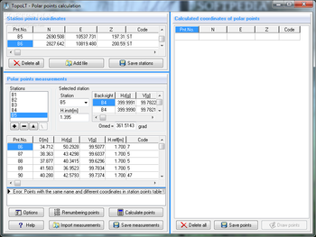
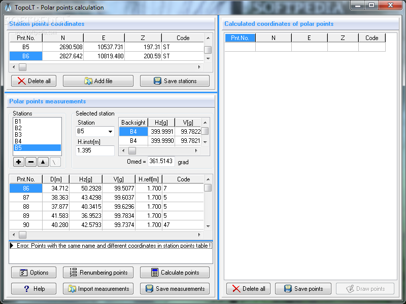
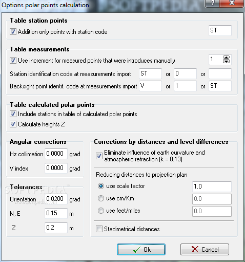
coordinates of sightshot points (polar points) can be calculated including the possibility to import measurements from the majority of existing total stations;
measurements can be received from an instrument through serial port;
points can be selected based on code and point codes can be modified;
point coordinates can be extracted from drawing and saved in different formats, including formats defined at instruments (total stations) or in formats defined by user;
coordinates tables for selected points can be created, including a separate table for station points;
3D model of the terrain and contour lines can be generated, volumes can be calculated without any restrictions (the volume obtained by intersecting a 3D surface with a plane or the volume between two 3D surfaces of any grid form or triangles);
3D models can be cut or joined;
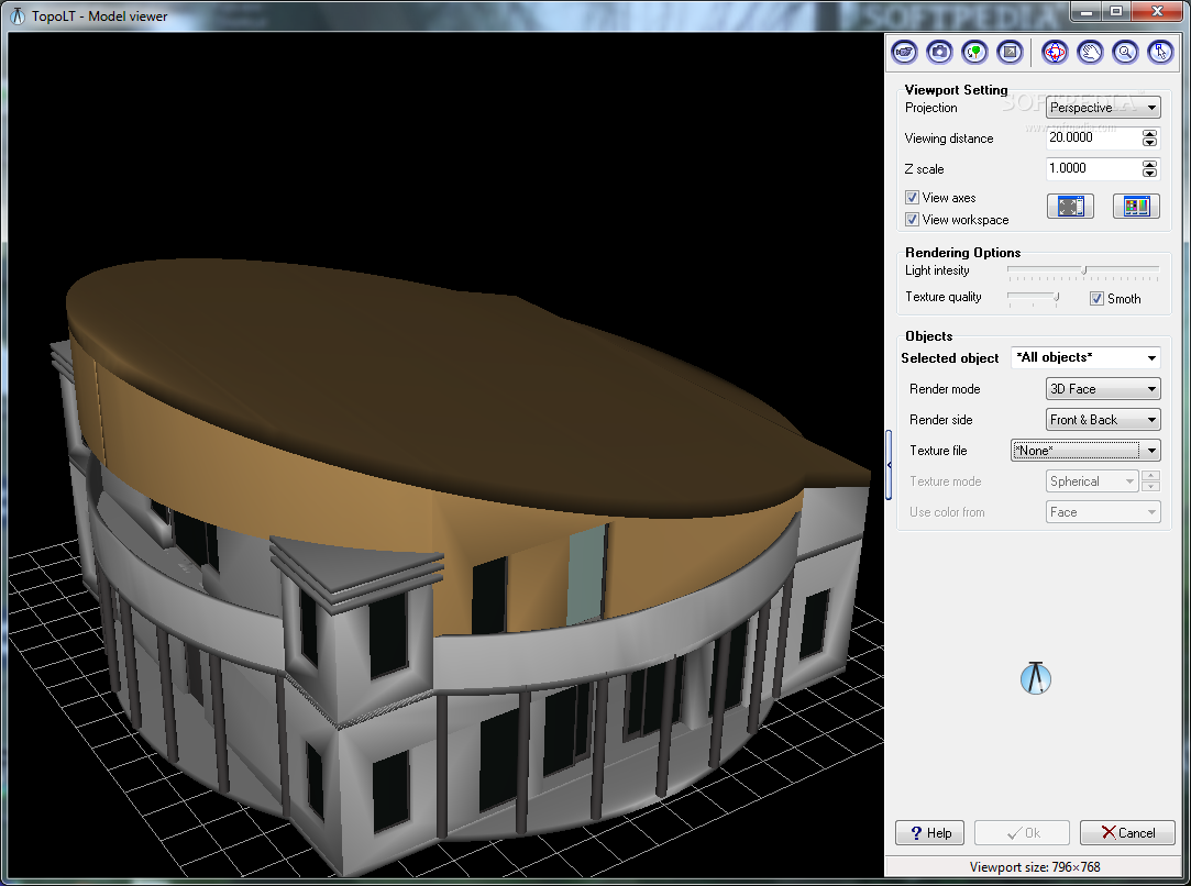
entities from a drawing with can be visualized in 3D with real time rendering, AVI movies can be saved with moving three-dimensional objects, images can be saved, 3ds files can be visualized, textures can be attached to 3D objects including attachment of images in coordinates for a photo-realistic visualization of 3D models. Visualization is available for functions that create 3D model and perform volumes calculation;
raster images can be transformed in order to achieve correlation with the coordinates system of the plan and raster images can be both cut and framed at the same time with the process of transformation, raster images can be saved in different formats, colors format can be changed;
point symbols (blocks) can be inserted, scaled, rotated or deleted based on point codes;
linetypes can be changed automatically according to the codes interpretation file;
tables with areas calculation can be created in the drawing or in the arr.tab file. These areas can be recorded in arr.txt file which can be imported in ARIA program database;
areas can be detached using usual methods from cadastre such as parallel, parallel to one direction, perpendicular, proportional, through an obliged point and with obliged opening;
the grid can be automaticaly drawn;
numbered sheets can be created in order to view or print plan by plan when there are chained plans;
border and title block can be drawn automatically while taking into consideration the printable area and paper format;
program configuration was made in order to cover situations as different as possible;
program works in different languages;
Where to buy?
Last updated price and discount information 9 years agoupdate now


 Windows XP and above
 View Screenshots(3)
 Comments
 Download


 Similar Software
 Recently Searched
 Software Categories
 Trending Software


 Like Us


