Works on: Windows 10 | Windows 8.1 | Windows 8 | Windows 7 | Windows XP | Windows 2000 | Windows 2003 | Windows 2008 | Windows 98 | Windows ME | Windows NT | Windows Vista | Windows 2012 SHA1 Hash: bf510234614c1099111783e836d33ab57488d10d Size: 4.6 MB File Format: zip
Rating: 2.5833333333333
out of 5
based on 24 user ratings
Publisher Website: External Link Downloads: 1597 License: Demo / Trial Version
TRANSDAT is a demo software by Killet Softwareentwicklung GbR and works on Windows 10, Windows 8.1, Windows 8, Windows 7, Windows XP, Windows 2000, Windows 2003, Windows 2008, Windows 98, Windows ME, Windows NT, Windows Vista, Windows 2012.
You can download TRANSDAT which is 4.6 MB in size and belongs to the software category Science CAD. TRANSDAT was released on 2016-09-24 and last updated on our database on 2017-04-15 and is currently at version 19.51.
Thank you for downloading from SoftPaz! Your download should start any moment now. It would be great if you could rate and share:
Rate this software:
Share in your network:
TRANSDAT Description
Data input, data output and file formats:
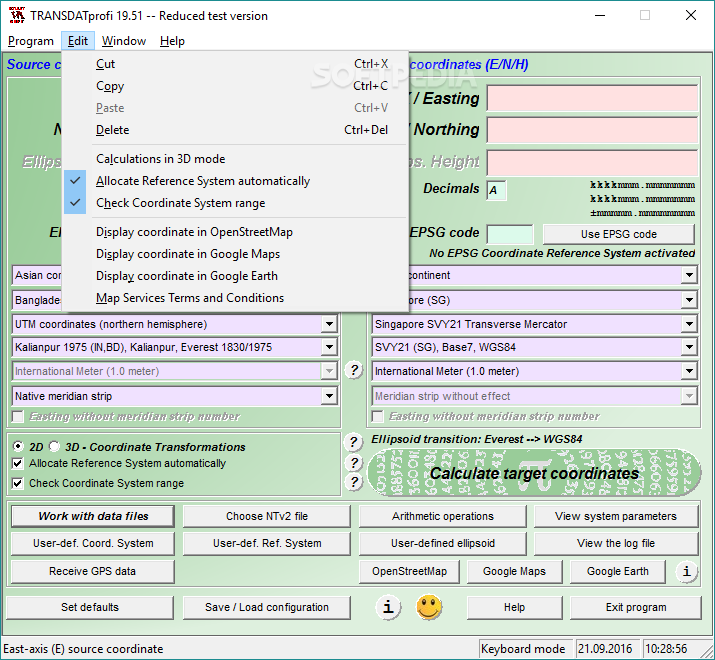
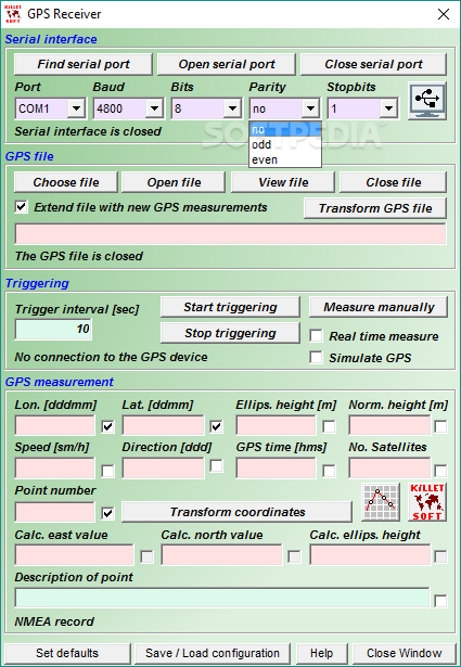
Keyboard Mode for direct input of coordinates;
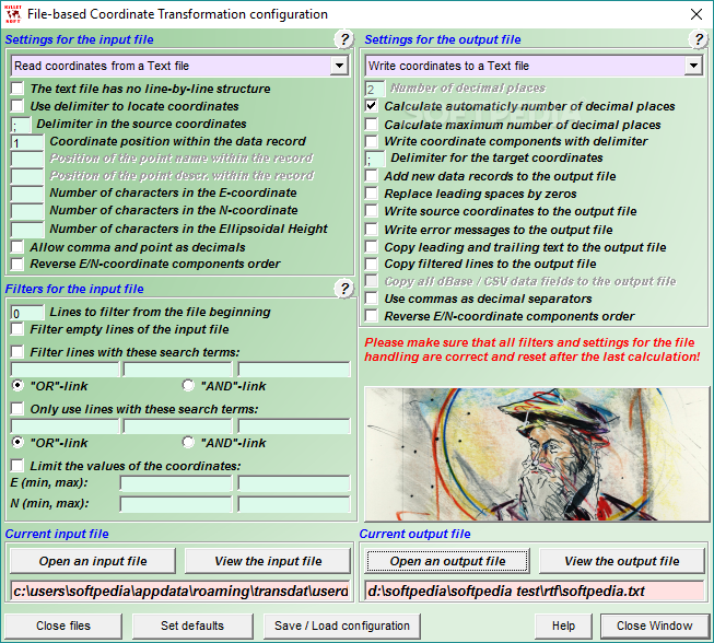
File Mode for data input from files and data output to files;
Batch Mode for batch processing of multiple files using a control file;
File formats Text, CSV, SDF, dBase, ArcShape and ArcGenerate for data input;
File formats Text, CSV, SDF, dBase, KLM, ArcShape and ArcGenerate for data output;
Conversion from one file format to another;
Very flexible file configuration;
Various filters for the input file;
Control of the notation of coordinates;
Copy function for Text, CSV, and dBase files;
Finding scattered coordinates in Text files;
Processing of text files without line orientation;
Shape to Shape function;
Shape to KLM function;
Support of the ArcGenerate GIS exchange format for geometries;
Log file with the results of the current session;
Export and import to / from configuration files;
One-click copy and paste of all coordinate components simultaneously.
Quality:
Strict formulas of Schatz, Schuhr, Klotz and Hooijberg;
Transformation parameters of the Surveying Authorities of the respective countries;
Consideration of the EPSG specifications;
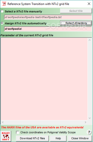
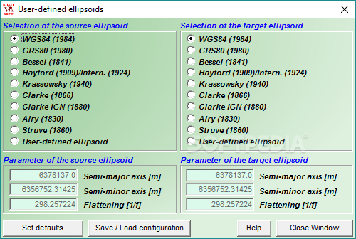
Helmert 7-parameter Bursa-Wolf and Molodenski reference system transitions;
Exact NTv2 transformations for many countries;
High-precision NTv2 transformations for the German Federal States and other states provinces;
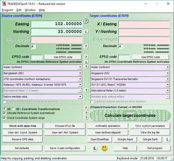
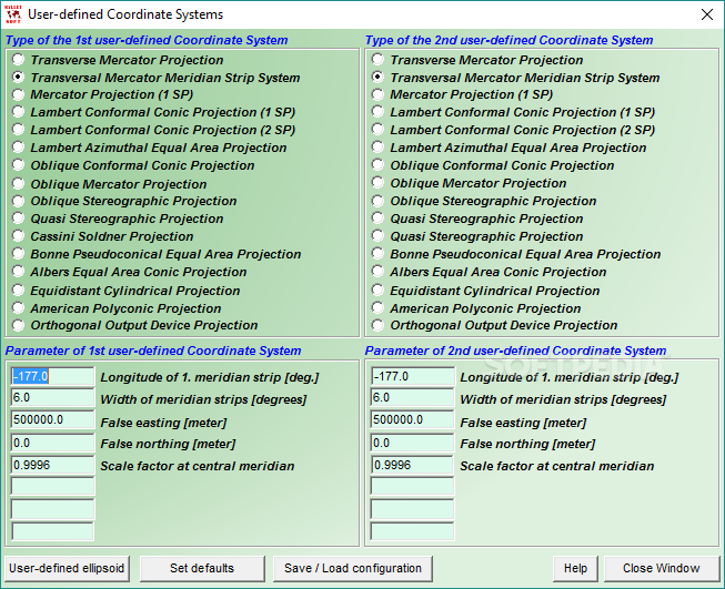
Source and target Coordinate Reference Systems;
World-wide and country-specific Coordinate Reference Systems;
Current and historical Coordinate Reference Systems;
Numeric and alphanumeric Coordinate Systems;
UTMRef, GEOREF, QTH, BNG and ING with different grid mesh sizes;


 Windows NT and above
 View Screenshots(10)
 Comments
 Download


 Similar Software
 Recently Searched
 Software Categories
 Trending Software


 Like Us


