Works on: Windows 10 | Windows 8.1 | Windows 8 | Windows 7 | Windows 2012 SHA1 Hash: 9c3167019cf6b55d8367551c1e6bfd11e65eb75f Size: 43.64 MB File Format: exe
Rating: 2.347826086
out of 5
based on 23 user ratings
Publisher Website: External Link Downloads: 625 License: Demo / Trial Version
Travel Time Map is a demo software by K-Sol and works on Windows 10, Windows 8.1, Windows 8, Windows 7, Windows 2012.
You can download Travel Time Map which is 43.64 MB in size and belongs to the software category Miscellaneous. Travel Time Map was released on 2016-03-18 and last updated on our database on 2017-04-12 and is currently at version 1.
Thank you for downloading from SoftPaz! Your download should start any moment now. It would be great if you could rate and share:
Rate this software:
Share in your network:
Travel Time Map Description
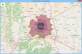
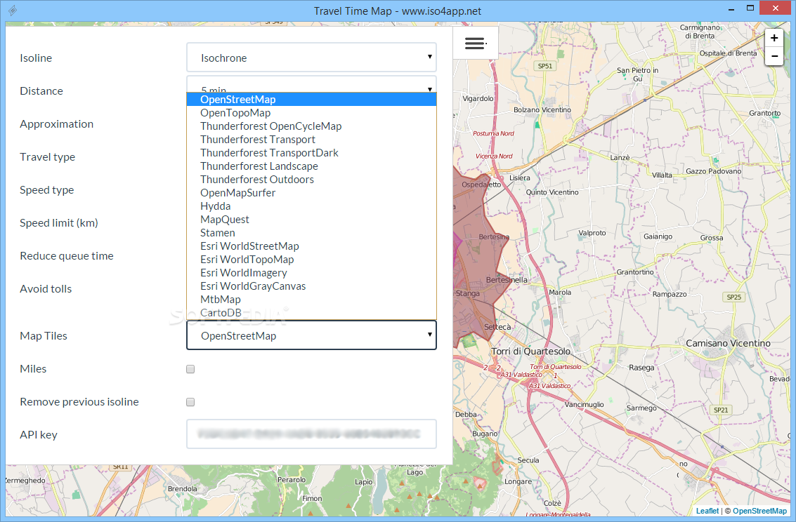
Travel Time Map is a relatively simple application that enables you to generate isolines to indicate the maximum distance that can be traveled in a specified period, as well as view which points on a map are placed at the same distance away from a particular point when traveling by road.
The program relies on the Iso4App API and serves as a demo for the service’s capabilities.
Test the Iso4App API from your desktop
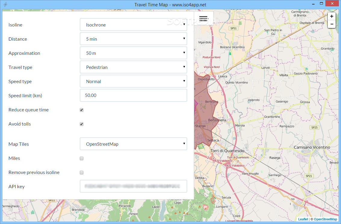
First and foremost, you should know that Travel Time Map requires a valid API key before any data can be processed. This key can be requested on the developer’s website, and it comes with several usage limitations.
Each operation requires a certain number of credits, and you can check how many you have left by logging into your newly created account. Of course, you can upgrade your API key to gain more credits.
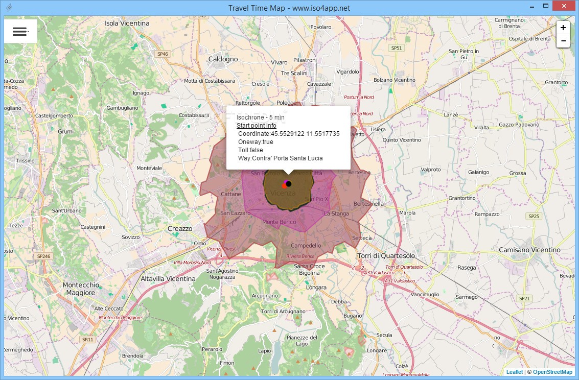
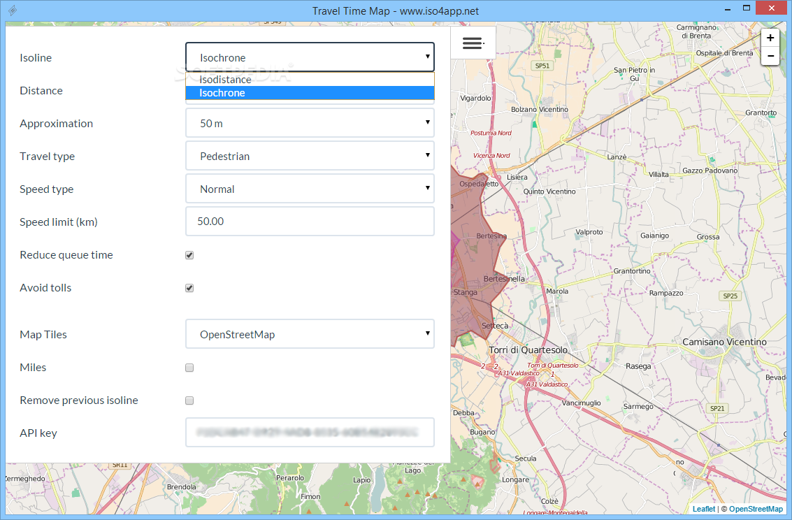
Generate isodistance and isochrone polygons
Travel Time Map gives you an idea of how much distance can be covered in a specified amount of time from a user-defined starting point. You can provide the travel time, method of transportation and speed limit, as well have the application reduce queue times and ignore tolls.
Moreover, the program is capable of depicting areas that are situated an equal distance away from a given point. This function is very useful in urban environments, as it shows which areas are easily reachable by road.
Powerful service that supports numerous countries and map tiles
While the Iso4App API does not cover the entire globe, areas such as Europe, North America, Central America, China and Australia-Oceania have already been implemented.
Furthermore, you can choose from multiple map tiles when generating isolines, including OpenStreetMap, CartoDB, MapQuest and OpenTopoMap.
All in all, Travel Time Map is an interesting application for those who wish to test out the Iso4App API, which can calculate maximum travel distances and travel times, as well as represent this data in the form of polygons using various map tiles.


 Windows 7 and above
 View Screenshots(5)
 Comments
 Download


 Similar Software
 Recently Searched
 Software Categories
 Trending Software


 Like Us


