Works on: Windows 10 | Windows 8.1 | Windows 8 | Windows 7 | Windows XP | Windows 2000 | Windows 2003 | Windows 2008 | Windows Vista | Windows 2012 SHA1 Hash: 4beb5e12de208e9a36d9dd59fa239b05d1c81985 Size: 7.92 MB File Format: msi
Rating: 2.347826086
out of 5
based on 23 user ratings
Publisher Website: External Link Downloads: 1449 License: Demo / Trial Version
AEC Roads is a demo software by AEC Logic and works on Windows 10, Windows 8.1, Windows 8, Windows 7, Windows XP, Windows 2000, Windows 2003, Windows 2008, Windows Vista, Windows 2012.
You can download AEC Roads which is 7.92 MB in size and belongs to the software category WEB Design. AEC Roads was released on 2013-09-25 and last updated on our database on 2017-04-26 and is currently at version 1.
Thank you for downloading from SoftPaz! Your download should start any moment now. It would be great if you could rate and share:
Rate this software:
Share in your network:
AEC Roads Description
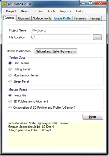
Growing global trend in the construction industry today is crossing new borders, especially when it comes to accurate and quick designing and dimensioning. Contracting companies and investors have raised their benchmarks regarding time, value for engineering hours and cost effective construction. To meet these demands they need an automation manager like AEC Roads. Accurate and interactive, AEC Roads is a 3D Project designer cum Quantity Estimation and Drawing application that can form an essential part of a Civil Engineers kit. AEC Roads can quickly prepare your Designs, Drawings, Dimensioning and Quantity Estimation. It is designed to speak Engineers language in a quickest possible time on a cost effective way. AEC Roads takes care of budding and busy engineers to use difficult AutoCAD drafting in 3D environment faster with ease. Quantity estimation and bill of quantities preparation are made simple through AEC Roads. From a given input coordinate point files plotted on 2D AutoCAD file, program automatically starts a Setup Wizard, determines Drawing Extents and takes alignment polyline from the user designs horizontal and vertical curves with failure notifications according to project requirements. Finally results in an output that is a 3D final Digital Terrain Model files, along with several coordinates for final construction.
Where to buy?
Last updated price and discount information 9 years agoupdate now


 Windows 2000 and above
 View Screenshots(1)
 Comments
 Download


 Similar Software


 Recently Searched
 Software Categories
 Trending Software


 Like Us


