Works on: Windows 10 | Windows 8.1 | Windows 8 | Windows 7 | Windows XP | Windows 2000 | Windows 2003 | Windows 2008 | Windows Vista | Windows 2012 SHA1 Hash: 6e771da13b85917b60463d9733bdd8daef086145 Size: 367.69 KB File Format: zip
Rating: 2.347826086
out of 5
based on 23 user ratings
Publisher Website: External Link Downloads: 254 License: Demo / Trial Version
England & Wales Road Map 1779 is a demo software by Euratlas Nussli and works on Windows 10, Windows 8.1, Windows 8, Windows 7, Windows XP, Windows 2000, Windows 2003, Windows 2008, Windows Vista, Windows 2012.
You can download England & Wales Road Map 1779 which is 367.69 KB in size and belongs to the software category Home and Education. England & Wales Road Map 1779 was released on 2012-02-13 and last updated on our database on 2017-04-23 and is currently at version 1.
Thank you for downloading from SoftPaz! Your download should start any moment now. It would be great if you could rate and share:
Rate this software:
Share in your network:
England & Wales Road Map 1779 Description
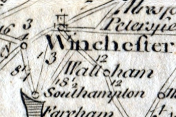
This is a digital copy of an antique print from the Modern Universal British Traveller showing the post-roads of England and Wales in the 18th century with distances in miles.The original title cartouche reads: A New & Most Accurate Map of the Roads of England and Wales with the Distances by the Milestones, and Other Most Exact Admensurations Between Town and Town.Main Features:- 1 digital map of England and Wales in JPG and PNG format.- Size of 8304 x 8224 pixels.- Real size, same as the original: 35 cm x 35 cm.
Where to buy?
Last updated price and discount information 9 years agoupdate now


 Windows 2000 and above
 View Screenshots(1)
 Comments
 Download


 Similar Software


 Recently Searched
 Software Categories
 Trending Software


 Like Us


