Version: 0 Last Updated: 17 Apr 2017 Release: 30 May 2013 Category: Others > Miscellaneous
Rate this software:
271 downloads
View Screenshots(1)
Comments
Download
Liked it? Tell others:
FieldNotes Details
Works on: Windows 10 | Windows 8.1 | Windows 8 | Windows 7 | Windows XP | Windows 2000 | Windows 2003 | Windows 2008 | Windows Vista | Windows 2012 SHA1 Hash: 5bd58784db082e3c4ae8499330906a47d2d4f2cd Size: 74.93 MB File Format: exe
Rating: 2.130434782
out of 5
based on 23 user ratings
Publisher Website: External Link Downloads: 271 License: Demo / Trial Version
FieldNotes is a demo software by Green Man Software Ltd and works on Windows 10, Windows 8.1, Windows 8, Windows 7, Windows XP, Windows 2000, Windows 2003, Windows 2008, Windows Vista, Windows 2012.
You can download FieldNotes which is 74.93 MB in size and belongs to the software category Miscellaneous. FieldNotes was released on 2013-05-30 and last updated on our database on 2017-04-17 and is currently at version 1.
Thank you for downloading from SoftPaz! Your download should start any moment now. It would be great if you could rate and share:
Rate this software:
Share in your network:
FieldNotes Description
FieldNotes is an exciting new product for new and experienced naturalists alike, designed to further interest in the natural environment and encourage information-sharing with other projects and organisations
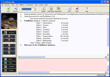
FieldNotes offers a progressive introduction to wildlife and environmental recording methods by combining intuitive observation and site description forms with a unique experience-based interface, encouraging you to work at the level of detail that you are comfortable with. Data-input forms are supported by a selection of tools and extensive underlying species and environmental data-sets, allowing you to quickly check relevant information to support your observations. The clear work-flow encourages you to add greater depth to your data by including photographs, diagrams and even map-feature datasets.
FieldNotes' fully-featured mapping interface uses OpenGL graphics to create publication-quality maps (optionally incorporating ing raster or vector background tiles), whilst the straight-forward report-creation tools allow you to publish your findings as a document or set of linked web-pages. Versatile data-sharing tools allow you to share selected subsets of your data with local and national recording schemes, using fully-automated data-transfer methods where possible.
Context-sensitive help, a range of introductory tutorials, example files and online user manual ensure that you will lose no time compiling your own database of observations - whether you live in the heart of the city or remote countryside.
Where to buy?
Last updated price and discount information 9 years agoupdate now


 Windows 2000 and above
 View Screenshots(1)
 Comments
 Download


 Similar Software
 Recently Searched
 Software Categories
 Trending Software
 Like Us


