Works on: Windows 10 | Windows 8.1 | Windows 8 | Windows 7 | Windows XP | Windows 2000 | Windows 2003 | Windows 2008 | Windows ME | Windows Vista | Windows 2012 SHA1 Hash: e234dbc0d37647f90474a579fa043edf8ee602a7 Size: 1.83 MB File Format: zip
Rating: 2.130434782
out of 5
based on 23 user ratings
Publisher Website: External Link Downloads: 173 License: Demo / Trial Version
GEODLL32 (English) is a demo software by C. Killet Software Ing.-gbr and works on Windows 10, Windows 8.1, Windows 8, Windows 7, Windows XP, Windows 2000, Windows 2003, Windows 2008, Windows ME, Windows Vista, Windows 2012.
You can download GEODLL32 (English) which is 1.83 MB in size and belongs to the software category Components Libraries. GEODLL32 (English) was released on 2012-07-03 and last updated on our database on 2017-04-17 and is currently at version 12.35.
Thank you for downloading from SoftPaz! Your download should start any moment now. It would be great if you could rate and share:
Rate this software:
Share in your network:
GEODLL32 (English) Description
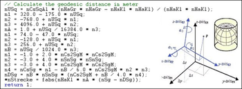
GeoDLL supports the development of geodetic software on various platforms by providing geodetic functions. GeoDLL contains precise calculations on the themes 2D and 3D coordinate transformation, geodetic datum shift and reference system converting, meridian strip changing, user defined coordinate and reference systems, distance calculations, Digital Elevation Model, NTv2 handling and BeTA2007 support, Direct / Inverse solutions, map function and geodetic converting functions. The most important application of GeoDLL is to include professional coordinate transformations in own programs. These coordinate and reference systems are supported: 1. The current and many historical coordinate and reference systems of all countries of the European Union (EU) including the eastern extensions and the systems of the European non-EU countries. 2. The European ETRS89 systems forced by INSPIRE with respect to the continental drift. 3 .The US and Canadian State Plane Coordinate Systems (SPCS) and other systems of the North American continent. 4. Many coordinate and reference systems of the countries of all continents and the world-wide used coordinate and reference systems. 5. World-wide NTv2 grid file supported coordinate transformations. 6. The coordinate and reference systems of the old and new German Federal States, the 40 Prussian Soldner Land Registers, the German 'Lagestatus', special reference systems of the German Federal States and BeTA2007. 7. User defined coordinate systems, reference systems and earth ellipsoids. GeoDLL comes with extensive documentation and is supplied as DLL file or as C++ source code for 32bit and 64bit architectures. The DLL works with most programming languages and it can be used with Microsoft Office programs. The DLL is written in C++ and was developed with Microsoft Visual Studio 2010. Thus very fast performance, compact code and high stability are assured. The functions of GeoDLL are prepared for multithreading.
Where to buy?
Last updated price and discount information 9 years agoupdate now


 Windows ME and above
 View Screenshots(2)
 Comments
 Download


 Similar Software
 Recently Searched
 Software Categories
 Trending Software


 Like Us


