Works on: Windows 10 | Windows 8.1 | Windows 8 | Windows 7 | Windows 2012 SHA1 Hash: da3f251bc5ca70097ee2efa2ab37111da5d323a4 Size: 2.83 MB File Format: zip
Rating: 2.260869565
out of 5
based on 23 user ratings
Downloads: 786 License: Free
GPS Altitude Chart is a free software by Michael Steger and works on Windows 10, Windows 8.1, Windows 8, Windows 7, Windows 2012.
You can download GPS Altitude Chart which is 2.83 MB in size and belongs to the software category Home and Education. GPS Altitude Chart was released on 2009-04-15 and last updated on our database on 2017-02-23 and is currently at version 1.2.
Thank you for downloading from SoftPaz! Your download should start any moment now. It would be great if you could rate and share:
Rate this software:
Share in your network:
GPS Altitude Chart Description
Did you ever want to print or publish the altitude profile of a tracklog recorded with a GPS receiver? As long as you are using Garmin software you probably were not too happy - at least I wasnt! Now there is a better way to generate an elevation plot:
GPS Altitude Chart application offers a viable solution when it comes to problems related to printing or publishing elevation plots.Just export your recorded GPS tracklog in the "GPS Exchange" format with any software suitable for your device (such as Garmin MapSource, g7ToWin, Fugawi, GPS Trackmaker or other
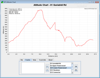
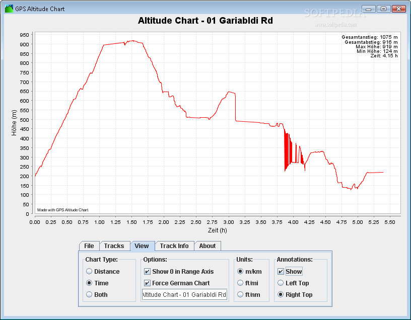
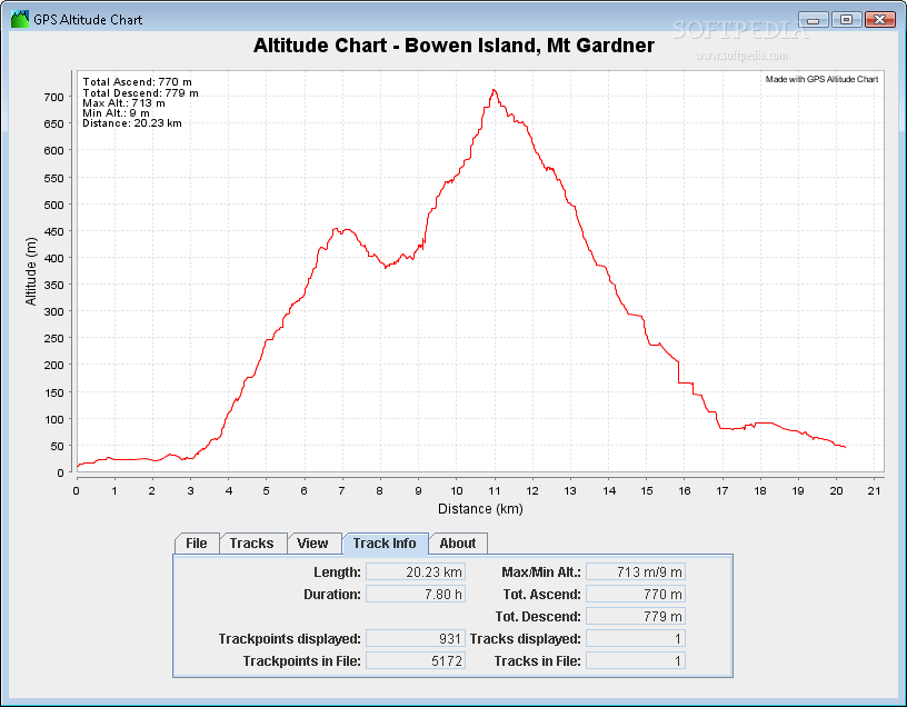
GPS Altitude Chart displays the elevation plots over distance, time or both on the screen. The displayed elevation profiles can be saved either as a PDF file or a PNG image for further use in any kind of document or web publishing.System requirementsJava Environment


 Windows 7 and above
 View Screenshots(3)
 Comments
 Download


 Similar Software
 Recently Searched
 Software Categories
 Trending Software


 Like Us


