Version: 2.1 Last Updated: 08 Mar 2017 Release: 01 Mar 2012 Category: Business > Applications
Rate this software:
250 downloads
View Screenshots(2)
Comments
Download
Liked it? Tell others:
MPSuperShape Details
Works on: Windows 10 | Windows 8.1 | Windows 8 | Windows 7 | Windows XP | Windows 2000 | Windows 2003 | Windows 2008 | Windows Vista | Windows 2012 SHA1 Hash: a388afcf36bd8dea41b278981c8e7a27179c0515 Size: 14.24 MB File Format: msi
Rating: 1.826086956
out of 5
based on 23 user ratings
Publisher Website: External Link Downloads: 250 License: Demo / Trial Version
MPSuperShape is a demo software by Winwaed Software Technology Llc and works on Windows 10, Windows 8.1, Windows 8, Windows 7, Windows XP, Windows 2000, Windows 2003, Windows 2008, Windows Vista, Windows 2012.
You can download MPSuperShape which is 14.24 MB in size and belongs to the software category Applications. MPSuperShape was released on 2012-03-01 and last updated on our database on 2017-03-08 and is currently at version 2.1.
Thank you for downloading from SoftPaz! Your download should start any moment now. It would be great if you could rate and share:
Rate this software:
Share in your network:
MPSuperShape Description
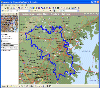
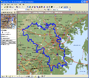
MPSuperShape is a shape manipulation tool for Microsoft MapPoint. MPSuperShape can be used to combine multiple shapes into one large shape, find the intersections (overlaps) between shapes, find boundary shapes around groups of pushpins, simplify shapes, delete multiple shapes, change shape colors, import/export shape files, and to create web pages. Import shape options include ESRI Shape (SHP) files, MapInfo MIF files, Keyhole (KML), and GML. MPSuperShape can also export to ESRI Shape (SHP) files; MapInfo MIF files; GML; KML; pushpins in shapes to Excel; and webpages that use Google Maps or Microsoft Bing Maps (Virtual Earth). Shapefile SHP and MapInfo MIF import/export options support different projections and coordinate systems.
Possible applications include: Combining drive-time areas to find the total area covered by existing depots; Finding territory overlaps; Finding areas which meet multiple characteristics; Finding territory boundaries around groups of customer pushpins; Transferring shapes to/from other GIS systems; Create webpages from MapPoint shapes and pushpins. MPSuperShape provides the following benefits: Combine multiple shapes; Find the intersection (overlap) between shapes; Find boundary shapes around a group of pushpins; Simplify shape definitions for improved MapPoint efficiency; Import shapes from external (non-MapPoint) files; Export shapes to external (non-MapPoint) files; Create webpages that use Bing Maps (Virtual Earth) or Google Maps to display MapPoint pushpins and/or shapes; Copy shapes between different MapPoint maps - reuse the same shapes on multiple maps. The import and export options support GML and KML. GML is an XML-based open GIS format that is managed by the Open Geospatial Consortium. KML ('Keyhole Markup') is the XML language for Google Earth, but it is also supported by Google Maps and Microsoft Bing Maps. Requirements: MapPoint 2006 (or later), .NET Framework 2.0 (or later), and Windows XP, Vista, or Windows 7 required.
Where to buy?
Last updated price and discount information 9 years agoupdate now


 Windows XP and above
 View Screenshots(2)
 Comments
 Download


 Similar Software
 Recently Searched
 Software Categories
 Trending Software

 Like Us


