Works on: Windows 10 | Windows 8.1 | Windows 8 | Windows 7 | Windows XP | Windows 2000 | Windows 2003 | Windows 2008 | Windows Vista | Windows 2012 SHA1 Hash: f1339cb74d5b23bbd4ba741c18fe60d877ea6dba Size: 14.86 MB File Format: zip
Rating: 1.782608695
out of 5
based on 23 user ratings
Publisher Website: External Link Downloads: 349 License: Demo / Trial Version
TopoLT is a demo software by CADWARE Engineering and works on Windows 10, Windows 8.1, Windows 8, Windows 7, Windows XP, Windows 2000, Windows 2003, Windows 2008, Windows Vista, Windows 2012.
You can download TopoLT which is 14.86 MB in size and belongs to the software category WEB Design. TopoLT was released on 2012-04-10 and last updated on our database on 2017-04-23 and is currently at version 10.4.
Thank you for downloading from SoftPaz! Your download should start any moment now. It would be great if you could rate and share:
Rate this software:
Share in your network:
TopoLT Description
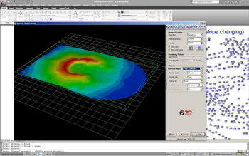
TopoLT is an indispensable tool for topography and cadaster, meeting all the requirements of the field and office work. The program is available in multiple languages and can be translated in any language by the user, and the functions can be configured for a wide range of situations. TopoLT is running on AutoCAD or other CAD platforms, bringing an extra level of performance to your CAD application with new functionalities which allow fast drawing, automatic data processing so you can obtain a complete plan in the shortest time possible. Main features of TopoLT are, draws directly points from coordinate files, draws coordinates from total station or sends coordinates from drawing directly to total station, point codes are translated according to a codes interpretation file defined by the user, points can be graphically drawn with or without elevations, elevations can be also obtained through interpolation, coordinates of sightshot points (polar points) can be calculated including the possibility to import measurements from the majority of existing total stations, and measurements can be received from an instrument through serial port.
Where to buy?
Last updated price and discount information 9 years agoupdate now


 Windows 2000 and above
 View Screenshots(1)
 Comments
 Download


 Recently Searched
 Software Categories
 Trending Software

 Like Us


 Similar Software


