Works on: Windows 10 | Windows 8.1 | Windows 8 | Windows 7 | Windows XP | Windows 2000 | Windows 2003 | Windows 2008 | Windows Vista | Windows 2012 SHA1 Hash: 305844abb2e87cf91ac6c53d9ecf9cdd34d6331c Size: 10.54 MB File Format: msi
Rating: 2.260869565
out of 5
based on 23 user ratings
Publisher Website: External Link Downloads: 3650 License: Demo / Trial Version
TrekkingMapEditor is a demo software by The Internet Man and works on Windows 10, Windows 8.1, Windows 8, Windows 7, Windows XP, Windows 2000, Windows 2003, Windows 2008, Windows Vista, Windows 2012.
You can download TrekkingMapEditor which is 10.54 MB in size and belongs to the software category Maps and Navigation. TrekkingMapEditor was released on 2015-08-13 and last updated on our database on 2017-04-27 and is currently at version 1.23.
Thank you for downloading from SoftPaz! Your download should start any moment now. It would be great if you could rate and share:
Rate this software:
Share in your network:
TrekkingMapEditor Description
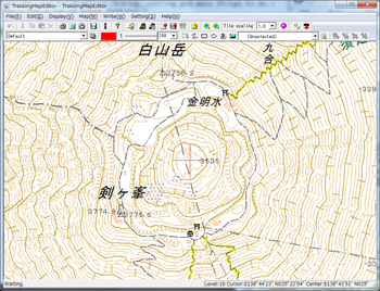
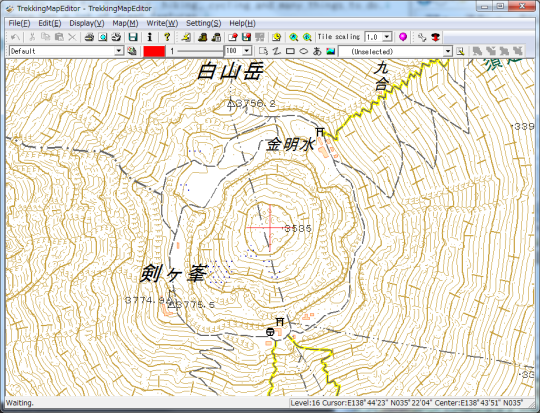
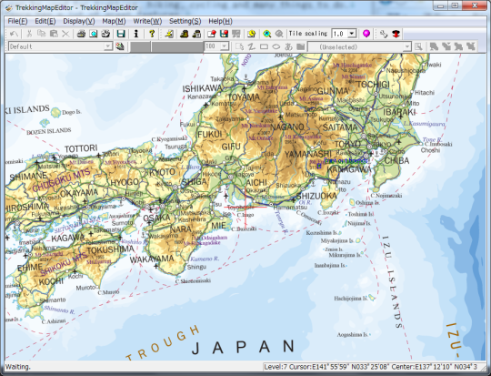
TrekkingMapEditor is GSI(Geospatial Information Authority of Japan) map viewer, and also print it.This map can be used for trekking, hiking, cycling and many things to do.This software has a lot of great features.* Zoom and scroll by the mouse.* To print the map is very easy.* Print out fit the paper.* High speed download Map tiles .* Magnetic line auto writing.* Latitude/Longitude line auto writing.* Distance line auto writing.* Scale line, Addtional line.* Customizable.* Print out with scale.* Color change.* Multi paper print out.* Can write rectangle, ellipse, string, picture.* Print history.
Many mountain climbers use this software in Japan.
Where to buy?
Last updated price and discount information 7 years agoupdate now


 Windows XP and above
 View Screenshots(2)
 Comments
 Download


 Similar Software


 Recently Searched
 Software Categories
 Trending Software


 Like Us


