Works on: Windows 10 | Windows 8.1 | Windows 8 | Windows 7 | Windows XP | Windows 2000 | Windows 2003 | Windows 2008 | Windows Vista | Windows 2012 SHA1 Hash: f8d5b119946eab485d2a48b99aae00de4efb5385 Size: 28.36 MB File Format: exe
Rating: 2.956521739
out of 5
based on 23 user ratings
Downloads: 3634 License: Free
EdiTrail is a free software by Aplicaciones Topograficas and works on Windows 10, Windows 8.1, Windows 8, Windows 7, Windows XP, Windows 2000, Windows 2003, Windows 2008, Windows Vista, Windows 2012.
You can download EdiTrail which is 28.36 MB in size and belongs to the software category Maps and Navigation. EdiTrail was released on 2014-11-20 and last updated on our database on 2017-04-27 and is currently at version 1.
Thank you for downloading from SoftPaz! Your download should start any moment now. It would be great if you could rate and share:
Rate this software:
Share in your network:
EdiTrail Description
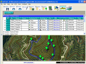
Importation/Exportation: Import/export trails to gpx file. Unlimited number of trails, and TrackPoints. Export to gpx, Excel, PDF, XPS and KML/KMZ.Data table: Very flexible data table that allows sorting by columns, with inheritance of data, attributes.Presentation on map: View on map in accordance with the active trail, which comes from providers of maps, as in Satellite mode (photos, orthophotos, etc), as Map mode, (Topographic map, street maps, etc).Digital Terrain Model, DTM: I have downloaded all the files, patches, with elevations of a point every 90 metres from around the world and 30 meters for United States, (DEM, digital elevation model), taken by the Shuttle Radar Topography Mission, SRTM. Ive put all these files on a dedicated server that can access all from anywhere.And with these files is created the DTM and contouring map of that we are seeing on the map in that moment.Longitudinal profile: Profile with direct and reciprocal relationship with the TrackPoints and WayPoints of the active trail.Edition of trails: Its the tool more powerful has the program and, in fact, was so started the program, to be able to edit my trails. You can create, modify, join, split and delete trails graphically. And the best is that this is done graphically on the map by clicking on the trail in one way easier.Display/management of photographs: I have created an images viewer so that you can see them easily and rotate them if necessary. The photograph can be Drag and drop on table, easily.AutoCAD/Bricscad/ZWCad: I have created the program, also, so that works within these three platforms. Thus, you can draw the trails, waypoints, digital model, map displayed, contouring and cloud of points, inside the CAD, with entities of CAD.Thus, you can have your trail in UTM XYZ WGS84 coordinates, with what that represents, thus you can include new maps of any active WMS service, (Warehouse Management System), and above all, with CAD tools.


 Windows 2000 and above
 View Screenshots(1)
 Comments
 Download


 Similar Software


 Recently Searched
 Software Categories
 Trending Software


 Like Us


