Version: 2 Last Updated: 10 Mar 2017 Release: 17 Dec 2015 Category: Science CAD
Rate this software:
1441 downloads
View Screenshots(12)
Comments
Download
Liked it? Tell others:
TRIANGULATION for AutoCAD Details
Works on: Windows 10 | Windows 8.1 | Windows 8 | Windows 7 | Windows XP | Windows 2000 | Windows 2003 | Windows 2008 | Windows Vista | Windows 2012 SHA1 Hash: 25fdc67cb4e2841e9fdac2c088bf03c4f681e276 Size: 678.41 KB File Format: zip
Rating: 2.347826086
out of 5
based on 23 user ratings
Publisher Website: External Link Downloads: 1441 License: Demo / Trial Version
TRIANGULATION for AutoCAD is a demo software by Rcad Software and works on Windows 10, Windows 8.1, Windows 8, Windows 7, Windows XP, Windows 2000, Windows 2003, Windows 2008, Windows Vista, Windows 2012.
You can download TRIANGULATION for AutoCAD which is 678.41 KB in size and belongs to the software category Science CAD. TRIANGULATION for AutoCAD was released on 2015-12-17 and last updated on our database on 2017-03-10 and is currently at version 2.
Thank you for downloading from SoftPaz! Your download should start any moment now. It would be great if you could rate and share:
Rate this software:
Share in your network:
TRIANGULATION for AutoCAD Description
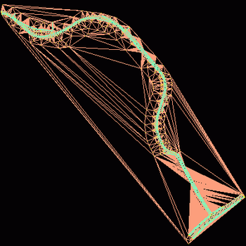
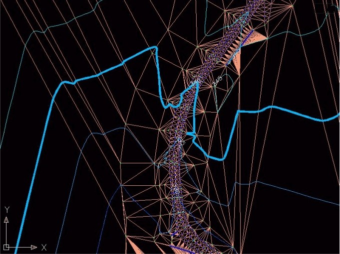
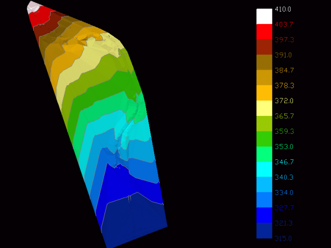
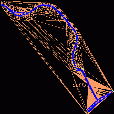
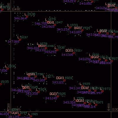
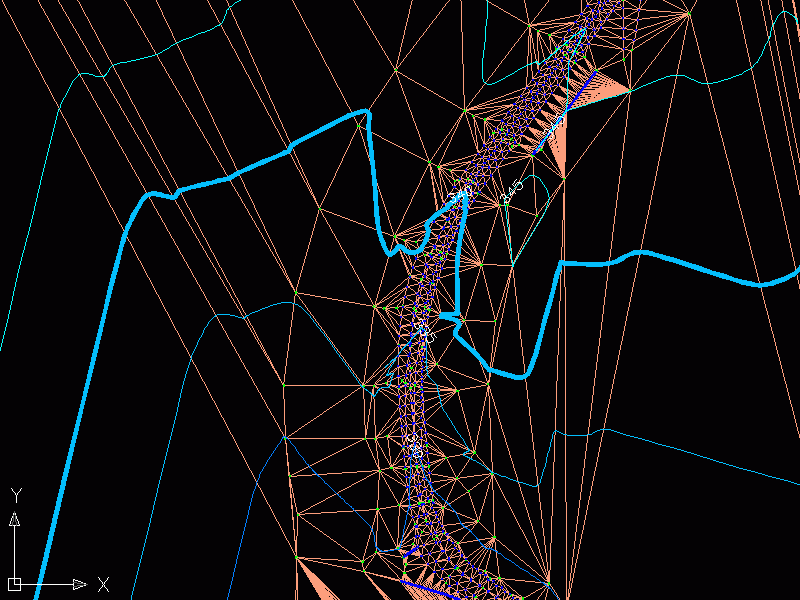
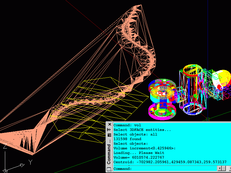
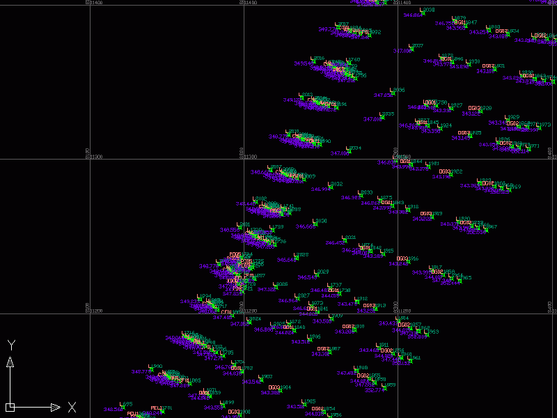
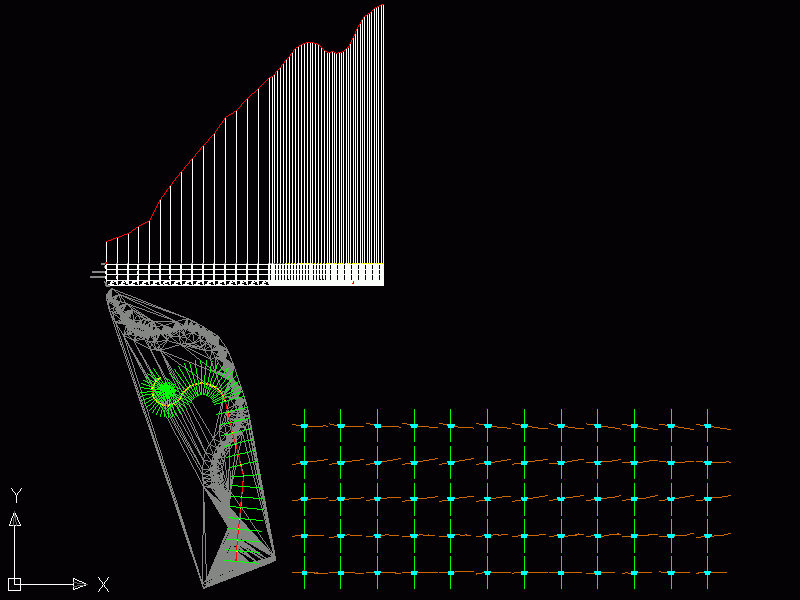
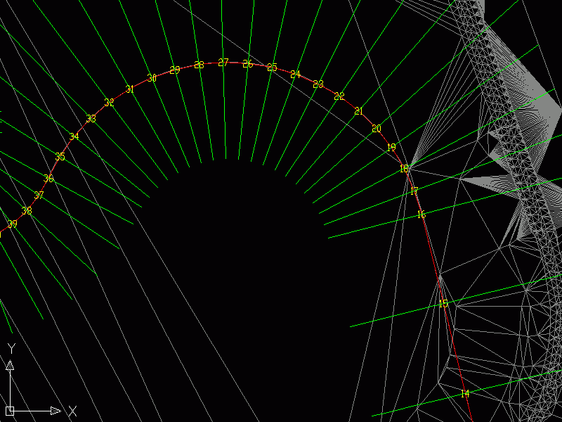
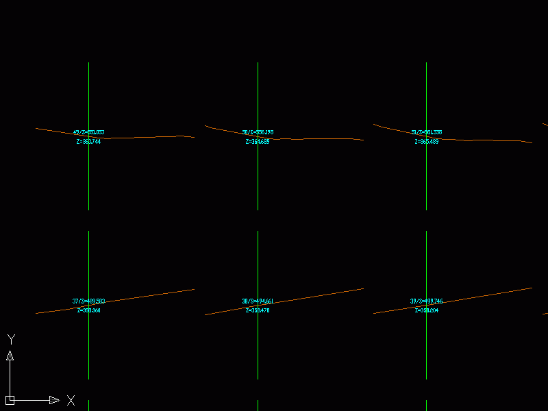
An application for AUTOCAD 2002-2016, which makes the triangulation of a set of POINT entities, the intersection curves (isolines) between a set of 3DFACE entities and a set of equidistance plans, horizontally or vertically and the volume and center of gravity of a set of bodies or between surfaces composed of 3DFACE entities. You can also load and draw a file of points having the format: Number X Y Z Code. The drawing of the XYZ files is made with POINT, 3DPOLY, SPLINE or BLOCK entities, according to a modifiable library of codes. The triangulation is performed on a convex hull of a set of points. You can triangulate million points! The isolines can be interpolated and their colors are according to a drawn legend. The isolines having Z a multiple of a value will be drawn thickened. You can define a clipping parallelepiped for isolines. You can also make the projection over a triangulation of a 2D POLYLINE and generate cross sections and a longitudinal profile corresponding at projection. The POLYLINE may contain arcs. Color-filled contour maps can be also generated.
In addition, you can draw a DWG file in Google Earth, by generating a KML file type. The DWG file can be in any projected coordinate system and from any part of the globe.
The price is for the first license! You can buy anytime after, other licenses at a lower price!


 Windows XP and above
 View Screenshots(12)
 Comments
 Download


 Similar Software
 Recently Searched
 Software Categories
 Trending Software


 Like Us


