Version: 1.1 Last Updated: 06 Mar 2017 Release: 03 Jul 2012 Category: Science CAD
Rate this software:
1155 downloads
View Screenshots(2)
Comments
Download
Liked it? Tell others:
DRAGSENS Details
Works on: Windows 10 | Windows 8.1 | Windows 8 | Windows 7 | Windows XP | Windows 2000 | Windows 2003 | Windows 2008 | Windows 98 | Windows ME | Windows Vista | Windows 2012 SHA1 Hash: 5e9dd8eee97a896d88ca393f02f54dc7543a8565 Size: 1.52 MB File Format: zip
Rating: 1.8
out of 5
based on 23 user ratings
Publisher Website: External Link Downloads: 1155 License: Demo / Trial Version
DRAGSENS is a demo software by C. Killet Software Ing.-gbr and works on Windows 10, Windows 8.1, Windows 8, Windows 7, Windows XP, Windows 2000, Windows 2003, Windows 2008, Windows 98, Windows ME, Windows Vista, Windows 2012.
You can download DRAGSENS which is 1.52 MB in size and belongs to the software category Science CAD. DRAGSENS was released on 2012-07-03 and last updated on our database on 2017-03-06 and is currently at version 1.1.
Thank you for downloading from SoftPaz! Your download should start any moment now. It would be great if you could rate and share:
Rate this software:
Share in your network:
DRAGSENS Description
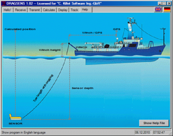
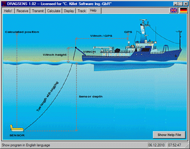
DRAGSENS Geo Software is used for the exact position estimation of a towed body, sensor, camera, array or net, dragged behind a ship, aircraft or vehicle. The software allows a real-time estimation of the position of a dragged sensor based on the location of a GPS-receiver. The sensor thereby can be dragged underwater, at water or earth surface or be airborne. The software calculates the position of the sensor along the direction opposite to the course by compensation of the drift rate, the rolling and the cornering ability of the towing vehicle. DRAGSENS receives current position data from a standard GPS string (RMC string). From these positions it averages a direction vector. Knowing the length of the tow cable, and the sensor depth, the sensor position is estimated and output in both kilometric and geographic formats. Suitable coefficients help keeping this estimation precise, considering, for example, the cable not as a straight line but as a parabolic arch. DRAGSENS runs under Microsoft Windows and uses two independent serial ports. That also may be USB ports, controlled by a serial port driver. The input port receives the standard position data from the NMEA bus, while the output port gives the sensor position back in both geographic and kilometric format. Several strings with coordinates in different coordinate systems, date / time and additional information are broadcast on the second serial port. They all follow the NMEA standard for the RMC specifications including the checksum bit for transfer controlling. This software at first was developed to add geo tags as an overlay with modern UTM coordinates on the footage taken by a towed underwater video camera. With suitable hardware the program delivers a video image, coming from a towed video camera, with the position as numeric overlay. It will also return the position of any towed sensor, including hydrophones, airguns, sonars or even nets.
Where to buy?
Last updated price and discount information 9 years agoupdate now



 Windows 98 and above
 View Screenshots(2)
 Comments
 Download





 Similar Software


 Recently Searched
 Software Categories
 Trending Software
 Like Us

