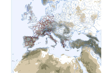
A vector map covering the Earths surface from the degree 15 west to 50 east, and from degree 20 north to 60 north, i.e. Europe in a wide geographical sense. This map contains the countries of Europe as they are in 2009. Note that only the Southern parts of Sweden and Norway are provided and that only a small strip of Finland appears. The map consists of 24 layers or planes. The layers surimposing order, names, fonts and colors can be changed according to Users choice. 1-mountains_200: 200 meter contour, 2-mountains_500: 500 meter contour, 3-mountains_1000: 1000 meter contour, 4-mountains_2000: 2000 meter contour, 5-mountains_3500: 3500 meter contour, 6-relief: red curves showing the main mountain ranges, 7-mountains_names: English names, in curve mode, of the main mountain ranges, 8-rivers: nearly 3000 medium water courses, 9-big_rivers: large rivers of Europe, 10-names_rivers: English names of the main rivers, in text format, 11-countries: shapes of the countries of Europe as they exist in 2009, without their administrative divisions, long and short names available in CorelDraw ObjectData, 12-dioceses: shapes of the first level administrative divisions (regions) in France, Spain, Belgium, United Kingdom, Italy and Greece, long and short names available in CorelDraw ObjectData, 16-seas: large water surfaces, i. e. seas and lakes, 18-cities_dots_3: 2020 lesser cities dots, endonym names available , 20-cities_dots_4: 386 cities marked by dots, endonym names available, 22-cities_dots_5: 258 major cities marked by dots, endonym names available, 23-fuzzy_borders: undefined borders areas, 24-coor_2: latitudes and longitudes with a precision of half a degree. LAYERS NECESSARY FOR ILLUSTRATOR ONLY: 13-dioceses_names: names of the first level administrative divisions (regions) in France, Spain, Belgium, United Kingdom, Italy 14-countries_names_short: short forms of the countries names 15-countries_names_long: long forms of the countries names and names of the special status territories 17-cities_names_3: 2020 lesser cities endonym names, 19-cities_names_4: 386 cities endonym names, 21-cities_names_5: 258 major cities endonym names.
Whats new in this version:


 Windows 2000 and above
 View Screenshots(1)
 Comments
 Download


 Similar Software


 Recently Searched
 Software Categories
 Trending Software


 Like Us


