Works on: Windows 10 | Windows 8.1 | Windows 8 | Windows 7 | Windows XP | Windows 2000 | Windows 2003 | Windows 2008 | Windows Vista | Windows 2012 SHA1 Hash: 6ed0fe335f1ec6b89283c09580f4aed37650e891 Size: 34.45 MB File Format: zip
Rating: 2.739130434
out of 5
based on 23 user ratings
Publisher Website: External Link Downloads: 2484 License: Demo / Trial Version
Post-Roads of Europe 1781 by John Rocque is a demo software by Euratlas Nussli and works on Windows 10, Windows 8.1, Windows 8, Windows 7, Windows XP, Windows 2000, Windows 2003, Windows 2008, Windows Vista, Windows 2012.
You can download Post-Roads of Europe 1781 by John Rocque which is 34.45 MB in size and belongs to the software category Maps and Navigation. Post-Roads of Europe 1781 by John Rocque was released on 2006-01-12 and last updated on our database on 2017-04-18 and is currently at version 1.
Thank you for downloading from SoftPaz! Your download should start any moment now. It would be great if you could rate and share:
Rate this software:
Share in your network:
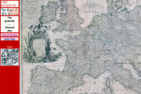
Post-Roads of Europe 1781 by John Rocque Description
Travel through the major European roads in the XVIIIth century, for all operating systems. A map of European Post-Roads by John Rocque 1752, reprinted in 1781. Documents provided in .jpg mode images and presented on html pages readable with a Web browser. - 24 images of 1912 x 2695 px x 72 dpi, each representing one of the 24 original sheets in real size. 24 images of 690 x 982 px x 72 dpi, each representing one of the 24 originals in reduced size. 288 images of 708 x 749 px x 72 dpi constituting real size sections of the main map, to facilitate spatial navigation. Map viewable in all operating systems. Web browser required but Internet connection not necessary.The original map as well as the presentation pages are fully bilingual: English and French. It is possible to edit the pictures with an imaging software.The trial version is limited to some details of the general map.
Where to buy?
Last updated price and discount information 9 years agoupdate now


 Windows 2000 and above
 View Screenshots(1)
 Comments
 Download


 Similar Software


 Recently Searched
 Software Categories
 Trending Software

 Like Us


