Works on: Windows 10 | Windows 8.1 | Windows 8 | Windows 7 | Windows XP | Windows 2000 | Windows 2003 | Windows 2008 | Windows Vista | Windows 2012 SHA1 Hash: ca96a45700d6d3e804bc421c9073ffe4491ecf64 Size: 124.61 MB File Format: exe
Rating: 2.130434782
out of 5
based on 23 user ratings
Downloads: 464 License: Free
VSceneGIS Desktop is a free software by vscenegis and works on Windows 10, Windows 8.1, Windows 8, Windows 7, Windows XP, Windows 2000, Windows 2003, Windows 2008, Windows Vista, Windows 2012.
You can download VSceneGIS Desktop which is 124.61 MB in size and belongs to the software category Home and Education. VSceneGIS Desktop was released on 2012-03-21 and last updated on our database on 2017-04-23 and is currently at version 0.9.
Thank you for downloading from SoftPaz! Your download should start any moment now. It would be great if you could rate and share:
Rate this software:
Share in your network:
VSceneGIS Desktop Description
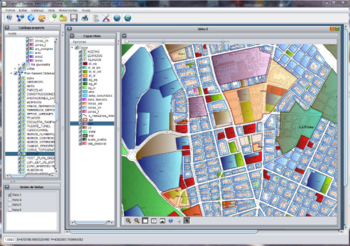
VSceneGIS Desktop. (GIS) Analysis, Computing and Editing. Customer Project Development, Analysis, Computing and GIS editing. VSceneGIS Desktop applies the concept of Tree and Graph Topology to implement the data model in a GIS. Validation, Editing and Topological BehaviorExport and import of data sources: PostgreSQL / PostGIS, Oracle, MySQL, SQLite / SpatiaLite, ShapeFile.Connection to services OGC WMS, WFS.
Whats new in this version:
Cersion 0.9.2u3 fixes major problems encountered in the previous update:Failed to allocate WMS projection. Assigned a fixed projection. Corrected.Failed to modify the connection parameters. Modified connection in memory but not kept. Corrected.The selection of items in Postgres was assigned with 10 meters of tolerance. Corrected.After a request information element is not allowed to select items. Corrected.


 Windows 2000 and above
 View Screenshots(1)
 Comments
 Download


 Similar Software


 Recently Searched
 Software Categories
 Trending Software


 Like Us


